
CHM KN.CHM - Earthquake Result Viewer
| ||||||||||||||||||
| ||||||||||||||||||
| ||||||||||||||||||
|
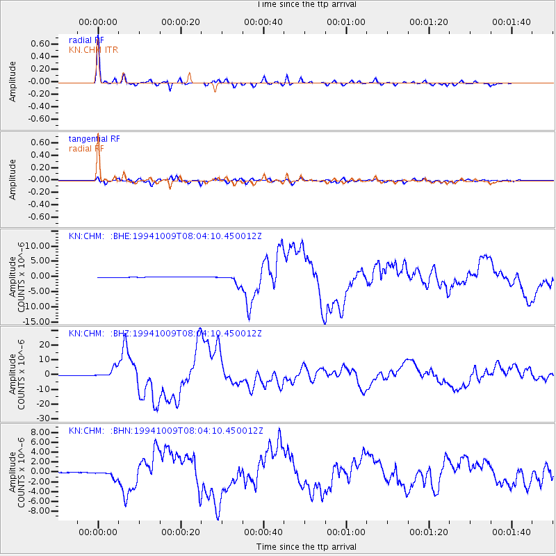
Signal To Noise
| Channel | StoN | STA | LTA |
| KN:CHM: :BHZ:19941009T08:04:10.450012Z | 60.568142 | 3.524598E-6 | 5.8192274E-8 |
| KN:CHM: :BHN:19941009T08:04:10.450012Z | 11.340818 | 7.4967323E-7 | 6.610398E-8 |
| KN:CHM: :BHE:19941009T08:04:10.450012Z | 14.607131 | 1.7062283E-6 | 1.16807904E-7 |
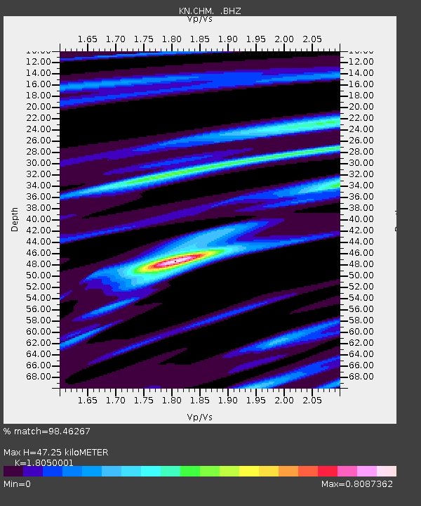
| Arrivals | |
| Ps | 6.4 SECOND |
| PpPs | 20 SECOND |
| PsPs/PpSs | 26 SECOND |

