You are here: Home > Network List > II - Global Seismograph Network (GSN - IRIS/IDA) Stations List
> Station WRAB Tennant Creek, NT, Australia > Earthquake Result Viewer
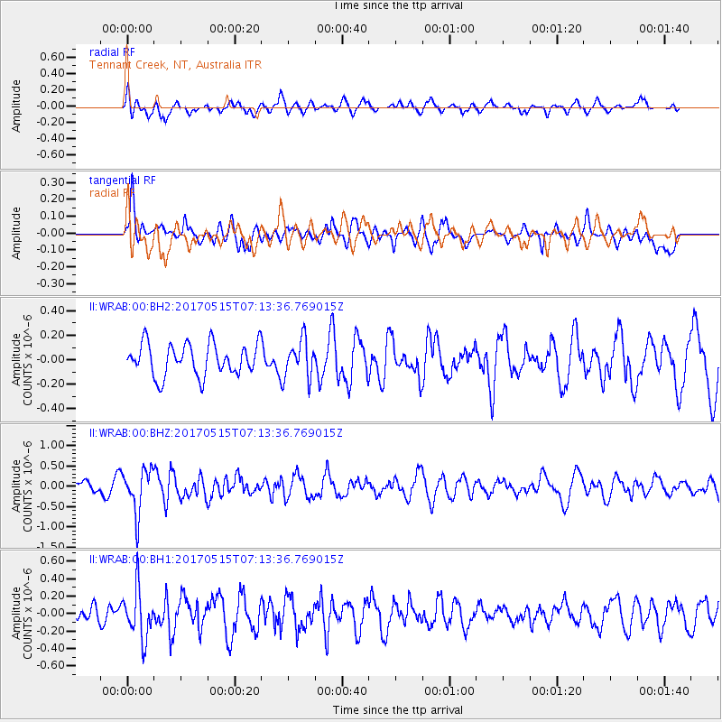
WRAB Tennant Creek, NT, Australia - Earthquake Result Viewer
*The percent match for this event was below the threshold and hence no stack was calculated.
| Earthquake location: |
Ryukyu Islands, Japan |
| Earthquake latitude/longitude: |
27.2/130.2 |
| Earthquake time(UTC): |
2017/05/15 (135) 07:05:36 GMT |
| Earthquake Depth: |
10 km |
| Earthquake Magnitude: |
5.5 Mww |
| Earthquake Catalog/Contributor: |
NEIC PDE/us |
|
| Network: |
II Global Seismograph Network (GSN - IRIS/IDA) |
| Station: |
WRAB Tennant Creek, NT, Australia |
| Lat/Lon: |
19.93 S/134.36 E |
| Elevation: |
366 m |
|
| Distance: |
47.0 deg |
| Az: |
174.589 deg |
| Baz: |
354.879 deg |
| Ray Param: |
$rayparam |
*The percent match for this event was below the threshold and hence was not used in the summary stack. |
|
| Radial Match: |
59.42238 % |
| Radial Bump: |
400 |
| Transverse Match: |
60.69518 % |
| Transverse Bump: |
400 |
| SOD ConfigId: |
2028011 |
| Insert Time: |
2017-05-29 07:10:28.392 +0000 |
| GWidth: |
2.5 |
| Max Bumps: |
400 |
| Tol: |
0.001 |
|
Signal To Noise
| Channel | StoN | STA | LTA |
| II:WRAB:00:BHZ:20170515T07:13:36.769015Z | 2.8397708 | 5.360481E-7 | 1.8876455E-7 |
| II:WRAB:00:BH1:20170515T07:13:36.769015Z | 1.875605 | 2.83692E-7 | 1.512536E-7 |
| II:WRAB:00:BH2:20170515T07:13:36.769015Z | 1.180605 | 1.5391929E-7 | 1.3037324E-7 |
| Arrivals |
| Ps | |
| PpPs | |
| PsPs/PpSs | |


