
CHM KN.CHM - Earthquake Result Viewer
| ||||||||||||||||||
| ||||||||||||||||||
| ||||||||||||||||||
|
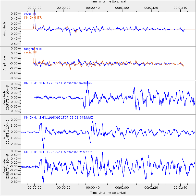
Signal To Noise
| Channel | StoN | STA | LTA |
| KN:CHM: :BHN:19980921T07:02:02.948999Z | 16.088356 | 7.275917E-7 | 4.5224738E-8 |
| KN:CHM: :BHE:19980921T07:02:02.948999Z | 4.382276 | 1.8349908E-7 | 4.1873008E-8 |
| KN:CHM: :BHZ:19980921T07:02:02.948999Z | 7.3592553 | 3.10566E-7 | 4.2200735E-8 |
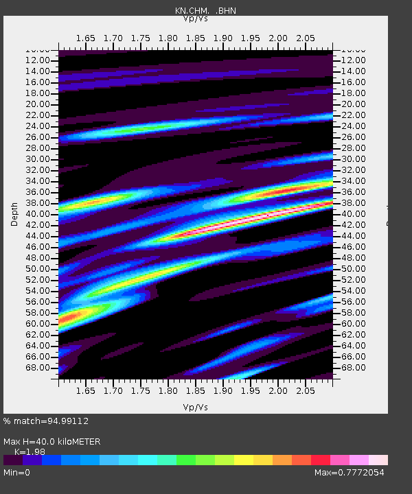
| Arrivals | |
| Ps | 6.5 SECOND |
| PpPs | 18 SECOND |
| PsPs/PpSs | 25 SECOND |

