You are here: Home > Network List > TA - USArray Transportable Network (new EarthScope stations) Stations List
> Station H31M Peel River, Yukon, CAN > Earthquake Result Viewer
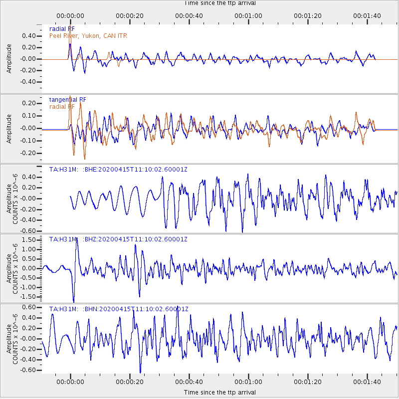
H31M Peel River, Yukon, CAN - Earthquake Result Viewer
*The percent match for this event was below the threshold and hence no stack was calculated.
| Earthquake location: |
Northern Colombia |
| Earthquake latitude/longitude: |
9.0/-74.4 |
| Earthquake time(UTC): |
2020/04/15 (106) 10:59:29 GMT |
| Earthquake Depth: |
53 km |
| Earthquake Magnitude: |
5.7 Mww |
| Earthquake Catalog/Contributor: |
NEIC PDE/us |
|
| Network: |
TA USArray Transportable Network (new EarthScope stations) |
| Station: |
H31M Peel River, Yukon, CAN |
| Lat/Lon: |
65.81 N/134.34 W |
| Elevation: |
642 m |
|
| Distance: |
69.7 deg |
| Az: |
337.658 deg |
| Baz: |
114.351 deg |
| Ray Param: |
$rayparam |
*The percent match for this event was below the threshold and hence was not used in the summary stack. |
|
| Radial Match: |
72.569466 % |
| Radial Bump: |
400 |
| Transverse Match: |
69.67052 % |
| Transverse Bump: |
400 |
| SOD ConfigId: |
21166931 |
| Insert Time: |
2020-04-29 11:23:26.908 +0000 |
| GWidth: |
2.5 |
| Max Bumps: |
400 |
| Tol: |
0.001 |
|
Signal To Noise
| Channel | StoN | STA | LTA |
| TA:H31M: :BHZ:20200415T11:10:02.60001Z | 7.339024 | 7.966096E-7 | 1.0854435E-7 |
| TA:H31M: :BHN:20200415T11:10:02.60001Z | 1.0641171 | 1.764572E-7 | 1.65825E-7 |
| TA:H31M: :BHE:20200415T11:10:02.60001Z | 1.8360544 | 2.7043842E-7 | 1.4729325E-7 |
| Arrivals |
| Ps | |
| PpPs | |
| PsPs/PpSs | |


