You are here: Home > Network List > TA - USArray Transportable Network (new EarthScope stations) Stations List
> Station R31K City Hall, Gustavus, AK, USA > Earthquake Result Viewer
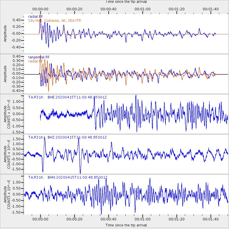
R31K City Hall, Gustavus, AK, USA - Earthquake Result Viewer
*The percent match for this event was below the threshold and hence no stack was calculated.
| Earthquake location: |
Northern Colombia |
| Earthquake latitude/longitude: |
9.0/-74.4 |
| Earthquake time(UTC): |
2020/04/15 (106) 10:59:29 GMT |
| Earthquake Depth: |
53 km |
| Earthquake Magnitude: |
5.7 Mww |
| Earthquake Catalog/Contributor: |
NEIC PDE/us |
|
| Network: |
TA USArray Transportable Network (new EarthScope stations) |
| Station: |
R31K City Hall, Gustavus, AK, USA |
| Lat/Lon: |
58.41 N/135.74 W |
| Elevation: |
15 m |
|
| Distance: |
67.5 deg |
| Az: |
330.02 deg |
| Baz: |
110.327 deg |
| Ray Param: |
$rayparam |
*The percent match for this event was below the threshold and hence was not used in the summary stack. |
|
| Radial Match: |
53.878017 % |
| Radial Bump: |
400 |
| Transverse Match: |
54.910213 % |
| Transverse Bump: |
400 |
| SOD ConfigId: |
21166931 |
| Insert Time: |
2020-04-29 11:24:36.334 +0000 |
| GWidth: |
2.5 |
| Max Bumps: |
400 |
| Tol: |
0.001 |
|
Signal To Noise
| Channel | StoN | STA | LTA |
| TA:R31K: :BHZ:20200415T11:09:48.85001Z | 4.481706 | 7.644712E-7 | 1.7057594E-7 |
| TA:R31K: :BHN:20200415T11:09:48.85001Z | 1.8617926 | 2.7063132E-7 | 1.4536063E-7 |
| TA:R31K: :BHE:20200415T11:09:48.85001Z | 3.3819535 | 5.5995093E-7 | 1.6557027E-7 |
| Arrivals |
| Ps | |
| PpPs | |
| PsPs/PpSs | |


