You are here: Home > Network List > US - United States National Seismic Network Stations List
> Station AMTX Amarillo, Texas, USA > Earthquake Result Viewer
AMTX Amarillo, Texas, USA - Earthquake Result Viewer
*The percent match for this event was below the threshold and hence no stack was calculated.
| Earthquake location: |
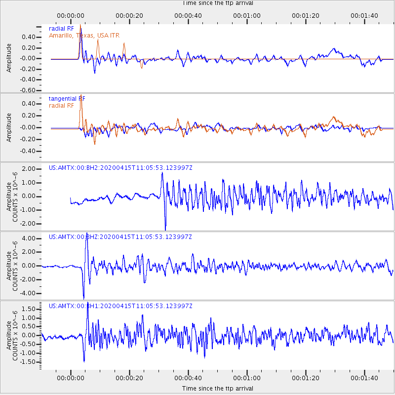
Northern Colombia |
| Earthquake latitude/longitude: |
9.0/-74.4 |
| Earthquake time(UTC): |
2020/04/15 (106) 10:59:29 GMT |
| Earthquake Depth: |
53 km |
| Earthquake Magnitude: |
5.7 Mww |
| Earthquake Catalog/Contributor: |
NEIC PDE/us |
|
| Network: |
US United States National Seismic Network |
| Station: |
AMTX Amarillo, Texas, USA |
| Lat/Lon: |
34.53 N/101.41 W |
| Elevation: |
1010 m |
|
| Distance: |
35.4 deg |
| Az: |
319.748 deg |
| Baz: |
129.374 deg |
| Ray Param: |
$rayparam |
*The percent match for this event was below the threshold and hence was not used in the summary stack. |
|
| Radial Match: |
66.83367 % |
| Radial Bump: |
400 |
| Transverse Match: |
65.11688 % |
| Transverse Bump: |
400 |
| SOD ConfigId: |
21166931 |
| Insert Time: |
2020-04-29 11:26:46.071 +0000 |
| GWidth: |
2.5 |
| Max Bumps: |
400 |
| Tol: |
0.001 |
|
Signal To Noise
| Channel | StoN | STA | LTA |
| US:AMTX:00:BHZ:20200415T11:05:53.123997Z | 7.500581 | 1.256416E-6 | 1.6750917E-7 |
| US:AMTX:00:BH1:20200415T11:05:53.123997Z | 2.4163444 | 4.428141E-7 | 1.8325787E-7 |
| US:AMTX:00:BH2:20200415T11:05:53.123997Z | 3.2461708 | 6.282423E-7 | 1.9353332E-7 |
| Arrivals |
| Ps | |
| PpPs | |
| PsPs/PpSs | |


