You are here: Home > Network List > UU - University of Utah Regional Network Stations List
> Station CCUT Cedar City, UT, USA > Earthquake Result Viewer
CCUT Cedar City, UT, USA - Earthquake Result Viewer
*The percent match for this event was below the threshold and hence no stack was calculated.
| Earthquake location: |
Northern Colombia |
| Earthquake latitude/longitude: |
9.0/-74.4 |
| Earthquake time(UTC): |
2020/04/15 (106) 10:59:29 GMT |
| Earthquake Depth: |
53 km |
| Earthquake Magnitude: |
5.7 Mww |
| Earthquake Catalog/Contributor: |
NEIC PDE/us |
|
| Network: |
UU University of Utah Regional Network |
| Station: |
CCUT Cedar City, UT, USA |
| Lat/Lon: |
37.55 N/113.36 W |
| Elevation: |
2127 m |
|
| Distance: |
45.1 deg |
| Az: |
315.195 deg |
| Baz: |
118.864 deg |
| Ray Param: |
$rayparam |
*The percent match for this event was below the threshold and hence was not used in the summary stack. |
|
| Radial Match: |
60.26569 % |
| Radial Bump: |
400 |
| Transverse Match: |
47.224995 % |
| Transverse Bump: |
400 |
| SOD ConfigId: |
21166931 |
| Insert Time: |
2020-04-29 11:27:42.985 +0000 |
| GWidth: |
2.5 |
| Max Bumps: |
400 |
| Tol: |
0.001 |
|
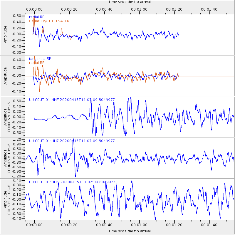
Signal To Noise
| Channel | StoN | STA | LTA |
| UU:CCUT:01:HHZ:20200415T11:07:09.804997Z | 4.0275497 | 5.0609026E-7 | 1.2565711E-7 |
| UU:CCUT:01:HHN:20200415T11:07:09.804997Z | 1.0989366 | 1.332221E-7 | 1.212282E-7 |
| UU:CCUT:01:HHE:20200415T11:07:09.804997Z | 5.6924343 | 3.1889718E-7 | 5.6021232E-8 |
| Arrivals |
| Ps | |
| PpPs | |
| PsPs/PpSs | |


