You are here: Home > Network List > TS - TERRAscope (Southern California Seismic Network) Stations List
> Station SBC Santa Barbara, California, USA > Earthquake Result Viewer
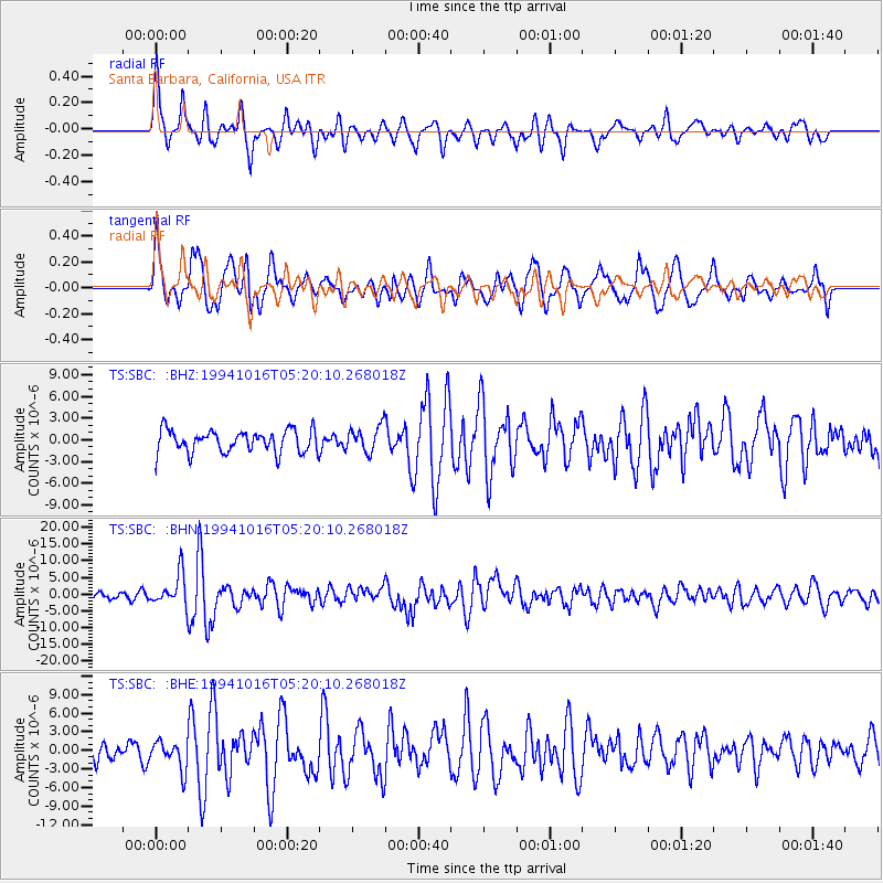
SBC Santa Barbara, California, USA - Earthquake Result Viewer
*The percent match for this event was below the threshold and hence no stack was calculated.
| Earthquake location: |
Kuril Islands |
| Earthquake latitude/longitude: |
45.7/149.2 |
| Earthquake time(UTC): |
1994/10/16 (289) 05:10:03 GMT |
| Earthquake Depth: |
139 km |
| Earthquake Magnitude: |
6.3 MB, 6.8 UNKNOWN, 6.7 MW |
| Earthquake Catalog/Contributor: |
WHDF/NEIC |
|
| Network: |
TS TERRAscope (Southern California Seismic Network) |
| Station: |
SBC Santa Barbara, California, USA |
| Lat/Lon: |
34.44 N/119.71 W |
| Elevation: |
90 m |
|
| Distance: |
67.0 deg |
| Az: |
63.877 deg |
| Baz: |
310.465 deg |
| Ray Param: |
$rayparam |
*The percent match for this event was below the threshold and hence was not used in the summary stack. |
|
| Radial Match: |
73.314514 % |
| Radial Bump: |
400 |
| Transverse Match: |
75.92492 % |
| Transverse Bump: |
400 |
| SOD ConfigId: |
4480 |
| Insert Time: |
2010-02-26 14:47:10.021 +0000 |
| GWidth: |
2.5 |
| Max Bumps: |
400 |
| Tol: |
0.001 |
|
Signal To Noise
| Channel | StoN | STA | LTA |
| TS:SBC: :BHN:19941016T05:20:10.268018Z | 5.4355183 | 4.9022274E-6 | 9.018878E-7 |
| TS:SBC: :BHE:19941016T05:20:10.268018Z | 1.7942553 | 2.32277E-6 | 1.2945592E-6 |
| TS:SBC: :BHZ:19941016T05:20:10.268018Z | 1.149992 | 1.773371E-6 | 1.5420726E-6 |
| Arrivals |
| Ps | |
| PpPs | |
| PsPs/PpSs | |


