CHM KN.CHM - Earthquake Result Viewer
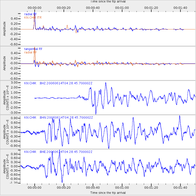
Earthquake location: Rat Islands, Aleutian Islands
Earthquake latitude/longitude: 51.8/177.1
Earthquake time(UTC): 2006/06/14 (165) 04:18:42 GMT
Earthquake Depth: 14 km
Earthquake Magnitude: 5.9 MB, 6.4 MS, 6.4 MW, 6.4 MW
Earthquake Catalog/Contributor: WHDF/NEIC
Network: KN Kyrgyz Seismic Telemetry Network
Station: CHM KN.CHM
Lat/Lon: 43.00 N/74.75 E
Elevation: 655 m
Distance: 64.2 deg
Az: 307.256 deg
Baz: 42.408 deg
Ray Param: 0.059052408
Estimated Moho Depth: 68.75 km
Estimated Crust Vp/Vs: 2.10
Assumed Crust Vp: 6.306 km/s
Estimated Crust Vs: 3.006 km/s
Estimated Crust Poisson's Ratio: 0.35
Radial Match: 95.39818 %
Radial Bump: 335
Transverse Match: 88.951805 %
Transverse Bump: 400
SOD ConfigId: 5745
Insert Time: 2010-03-08 19:15:57.770 +0000
GWidth: 2.5
Max Bumps: 400
Tol: 0.001

Signal To Noise

ChannelStoNSTALTA
KN:CHM: :BHN:20060614T04:28:45.700002Z1.35508335.3216823E-83.927199E-8
KN:CHM: :BHE:20060614T04:28:45.700002Z2.20522339.850542E-84.4669132E-8
KN:CHM: :BHZ:20060614T04:28:45.700002Z4.60320572.2374478E-74.8606296E-8
Arrivals
Ps12 SECOND
PpPs33 SECOND
PsPs/PpSs45 SECOND