You are here: Home > Network List > TA - USArray Transportable Network (new EarthScope stations) Stations List
> Station H16K Elim, AK, USA > Earthquake Result Viewer
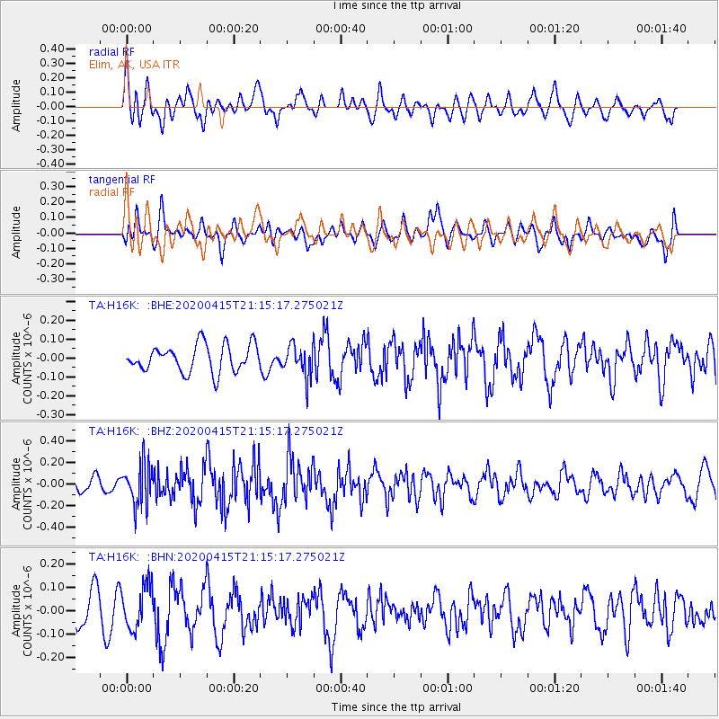
H16K Elim, AK, USA - Earthquake Result Viewer
*The percent match for this event was below the threshold and hence no stack was calculated.
| Earthquake location: |
Northern Molucca Sea |
| Earthquake latitude/longitude: |
1.1/126.7 |
| Earthquake time(UTC): |
2020/04/15 (106) 21:03:36 GMT |
| Earthquake Depth: |
29 km |
| Earthquake Magnitude: |
5.6 Mww |
| Earthquake Catalog/Contributor: |
NEIC PDE/us |
|
| Network: |
TA USArray Transportable Network (new EarthScope stations) |
| Station: |
H16K Elim, AK, USA |
| Lat/Lon: |
64.64 N/162.24 W |
| Elevation: |
216 m |
|
| Distance: |
81.0 deg |
| Az: |
24.363 deg |
| Baz: |
253.257 deg |
| Ray Param: |
$rayparam |
*The percent match for this event was below the threshold and hence was not used in the summary stack. |
|
| Radial Match: |
60.436882 % |
| Radial Bump: |
400 |
| Transverse Match: |
47.17951 % |
| Transverse Bump: |
400 |
| SOD ConfigId: |
21166931 |
| Insert Time: |
2020-04-29 21:10:39.313 +0000 |
| GWidth: |
2.5 |
| Max Bumps: |
400 |
| Tol: |
0.001 |
|
Signal To Noise
| Channel | StoN | STA | LTA |
| TA:H16K: :BHZ:20200415T21:15:17.275021Z | 3.388925 | 1.9042946E-7 | 5.61917E-8 |
| TA:H16K: :BHN:20200415T21:15:17.275021Z | 1.2975074 | 9.103805E-8 | 7.01638E-8 |
| TA:H16K: :BHE:20200415T21:15:17.275021Z | 1.135032 | 8.2172924E-8 | 7.239701E-8 |
| Arrivals |
| Ps | |
| PpPs | |
| PsPs/PpSs | |


