
CHM KN.CHM - Earthquake Result Viewer
| ||||||||||||||||||
| ||||||||||||||||||
| ||||||||||||||||||
|
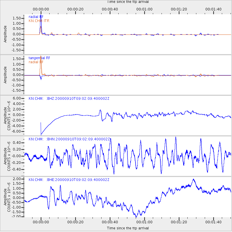
Signal To Noise
| Channel | StoN | STA | LTA |
| KN:CHM: :BHN:20000910T09:02:09.400002Z | 1.0573355 | 1.3841996E-7 | 1.3091393E-7 |
| KN:CHM: :BHE:20000910T09:02:09.400002Z | 0.72546625 | 2.3151479E-6 | 3.1912552E-6 |
| KN:CHM: :BHZ:20000910T09:02:09.400002Z | 0.85276526 | 1.7642676E-6 | 2.0688785E-6 |
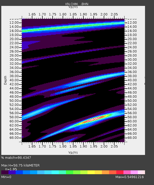
| Arrivals | |
| Ps | 9.4 SECOND |
| PpPs | 26 SECOND |
| PsPs/PpSs | 35 SECOND |

