You are here: Home > Network List > AV - Alaska Volcano Observatory Stations List
> Station SPCR Ckakachatna River, Mount Spurr, Alaska > Earthquake Result Viewer
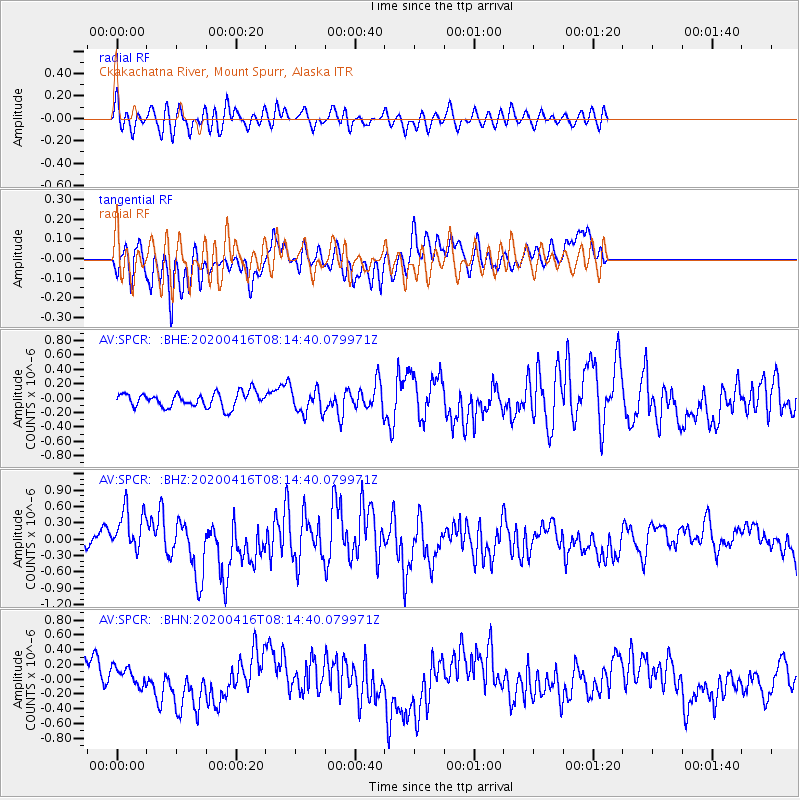
SPCR Ckakachatna River, Mount Spurr, Alaska - Earthquake Result Viewer
*The percent match for this event was below the threshold and hence no stack was calculated.
| Earthquake location: |
North Of Honduras |
| Earthquake latitude/longitude: |
16.9/-85.7 |
| Earthquake time(UTC): |
2020/04/16 (107) 08:04:37 GMT |
| Earthquake Depth: |
10 km |
| Earthquake Magnitude: |
6.0 mww |
| Earthquake Catalog/Contributor: |
NEIC PDE/us |
|
| Network: |
AV Alaska Volcano Observatory |
| Station: |
SPCR Ckakachatna River, Mount Spurr, Alaska |
| Lat/Lon: |
61.20 N/152.21 W |
| Elevation: |
984 m |
|
| Distance: |
64.0 deg |
| Az: |
330.396 deg |
| Baz: |
102.449 deg |
| Ray Param: |
$rayparam |
*The percent match for this event was below the threshold and hence was not used in the summary stack. |
|
| Radial Match: |
68.931786 % |
| Radial Bump: |
400 |
| Transverse Match: |
68.69654 % |
| Transverse Bump: |
400 |
| SOD ConfigId: |
21166931 |
| Insert Time: |
2020-04-30 08:08:55.814 +0000 |
| GWidth: |
2.5 |
| Max Bumps: |
400 |
| Tol: |
0.001 |
|
Signal To Noise
| Channel | StoN | STA | LTA |
| AV:SPCR: :BHZ:20200416T08:14:40.079971Z | 2.5427012 | 4.2212068E-7 | 1.660127E-7 |
| AV:SPCR: :BHN:20200416T08:14:40.079971Z | 0.8254831 | 1.5377789E-7 | 1.8628837E-7 |
| AV:SPCR: :BHE:20200416T08:14:40.079971Z | 1.7188845 | 1.7345386E-7 | 1.0091072E-7 |
| Arrivals |
| Ps | |
| PpPs | |
| PsPs/PpSs | |


