CHM KN.CHM - Earthquake Result Viewer
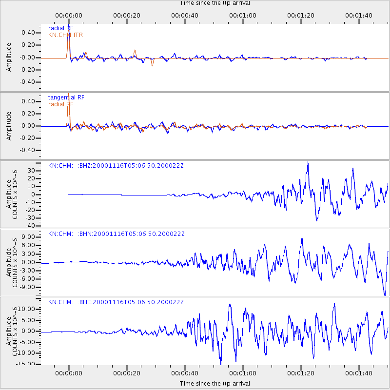
Earthquake location: New Ireland Region, P.N.G.
Earthquake latitude/longitude: -4.0/152.2
Earthquake time(UTC): 2000/11/16 (321) 04:54:56 GMT
Earthquake Depth: 33 km
Earthquake Magnitude: 6.0 MB, 8.2 MS, 8.0 MW, 8.0 ME
Earthquake Catalog/Contributor: WHDF/NEIC
Network: KN Kyrgyz Seismic Telemetry Network
Station: CHM KN.CHM
Lat/Lon: 43.00 N/74.75 E
Elevation: 655 m
Distance: 83.5 deg
Az: 313.895 deg
Baz: 101.509 deg
Ray Param: 0.046074677
Estimated Moho Depth: 32.5 km
Estimated Crust Vp/Vs: 1.99
Assumed Crust Vp: 6.306 km/s
Estimated Crust Vs: 3.165 km/s
Estimated Crust Poisson's Ratio: 0.33
Radial Match: 96.82268 %
Radial Bump: 243
Transverse Match: 83.50785 %
Transverse Bump: 400
SOD ConfigId: 3744
Insert Time: 2010-03-08 19:16:53.627 +0000
GWidth: 2.5
Max Bumps: 400
Tol: 0.001

Signal To Noise

ChannelStoNSTALTA
KN:CHM: :BHN:20001116T05:06:50.200022Z2.48946389.647888E-73.8754882E-7
KN:CHM: :BHE:20001116T05:06:50.200022Z1.95147796.7865994E-73.4776718E-7
KN:CHM: :BHZ:20001116T05:06:50.200022Z1.06669833.8124736E-73.5740882E-7
Arrivals
Ps5.2 SECOND
PpPs15 SECOND
PsPs/PpSs20 SECOND