You are here: Home > Network List > CI - Caltech Regional Seismic Network Stations List
> Station MPP McPhearson Peak > Earthquake Result Viewer
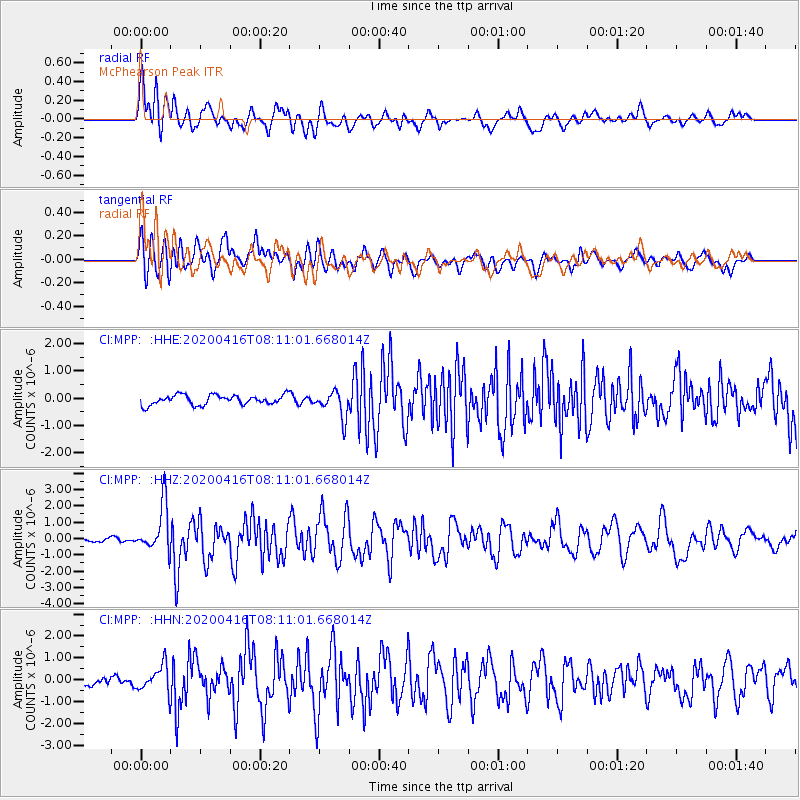
MPP McPhearson Peak - Earthquake Result Viewer
*The percent match for this event was below the threshold and hence no stack was calculated.
| Earthquake location: |
North Of Honduras |
| Earthquake latitude/longitude: |
16.9/-85.7 |
| Earthquake time(UTC): |
2020/04/16 (107) 08:04:37 GMT |
| Earthquake Depth: |
10 km |
| Earthquake Magnitude: |
6.0 mww |
| Earthquake Catalog/Contributor: |
NEIC PDE/us |
|
| Network: |
CI Caltech Regional Seismic Network |
| Station: |
MPP McPhearson Peak |
| Lat/Lon: |
34.89 N/119.81 W |
| Elevation: |
1739 m |
|
| Distance: |
35.3 deg |
| Az: |
307.051 deg |
| Baz: |
111.677 deg |
| Ray Param: |
$rayparam |
*The percent match for this event was below the threshold and hence was not used in the summary stack. |
|
| Radial Match: |
73.14259 % |
| Radial Bump: |
400 |
| Transverse Match: |
64.09543 % |
| Transverse Bump: |
400 |
| SOD ConfigId: |
21166931 |
| Insert Time: |
2020-04-30 08:12:50.909 +0000 |
| GWidth: |
2.5 |
| Max Bumps: |
400 |
| Tol: |
0.001 |
|
Signal To Noise
| Channel | StoN | STA | LTA |
| CI:MPP: :HHZ:20200416T08:11:01.668014Z | 10.540147 | 1.4453551E-6 | 1.3712855E-7 |
| CI:MPP: :HHN:20200416T08:11:01.668014Z | 2.7774367 | 6.0949094E-7 | 2.1944369E-7 |
| CI:MPP: :HHE:20200416T08:11:01.668014Z | 2.7308369 | 4.834461E-7 | 1.770322E-7 |
| Arrivals |
| Ps | |
| PpPs | |
| PsPs/PpSs | |


