CHM KN.CHM - Earthquake Result Viewer
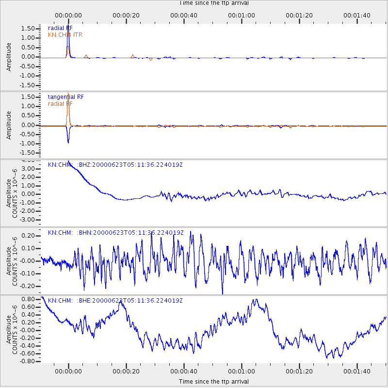
Earthquake location: Northern Molucca Sea
Earthquake latitude/longitude: 1.3/126.3
Earthquake time(UTC): 2000/06/23 (175) 05:01:54 GMT
Earthquake Depth: 65 km
Earthquake Magnitude: 6.0 MB, 5.1 MS, 5.8 MW, 5.8 MW
Earthquake Catalog/Contributor: WHDF/NEIC
Network: KN Kyrgyz Seismic Telemetry Network
Station: CHM KN.CHM
Lat/Lon: 43.00 N/74.75 E
Elevation: 655 m
Distance: 61.9 deg
Az: 319.367 deg
Baz: 117.45 deg
Ray Param: 0.06044098
Estimated Moho Depth: 57.0 km
Estimated Crust Vp/Vs: 2.08
Assumed Crust Vp: 6.306 km/s
Estimated Crust Vs: 3.035 km/s
Estimated Crust Poisson's Ratio: 0.35
Radial Match: 99.24861 %
Radial Bump: 103
Transverse Match: 98.183914 %
Transverse Bump: 185
SOD ConfigId: 3744
Insert Time: 2010-03-08 19:17:13.446 +0000
GWidth: 2.5
Max Bumps: 400
Tol: 0.001

Signal To Noise

ChannelStoNSTALTA
KN:CHM: :BHN:20000623T05:11:36.224019Z2.2667576.111058E-82.6959476E-8
KN:CHM: :BHE:20000623T05:11:36.224019Z0.6539641.3118394E-62.005981E-6
KN:CHM: :BHZ:20000623T05:11:36.224019Z0.624451948.481436E-71.3582209E-6
Arrivals
Ps10 SECOND
PpPs27 SECOND
PsPs/PpSs37 SECOND