
CHM KN.CHM - Earthquake Result Viewer
| ||||||||||||||||||
| ||||||||||||||||||
| ||||||||||||||||||
|
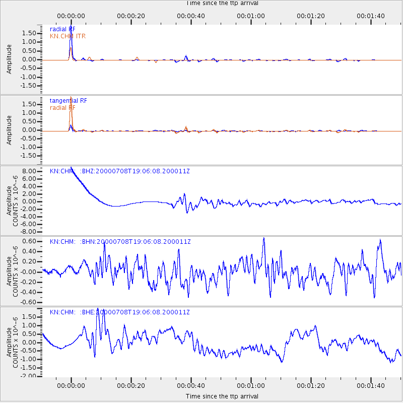
Signal To Noise
| Channel | StoN | STA | LTA |
| KN:CHM: :BHN:20000708T19:06:08.200011Z | 1.0355603 | 2.4597927E-7 | 2.3753255E-7 |
| KN:CHM: :BHE:20000708T19:06:08.200011Z | 0.5780324 | 2.4781912E-6 | 4.2872875E-6 |
| KN:CHM: :BHZ:20000708T19:06:08.200011Z | 0.6206381 | 1.729272E-6 | 2.786281E-6 |
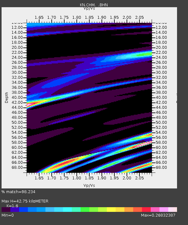
| Arrivals | |
| Ps | 4.3 SECOND |
| PpPs | 17 SECOND |
| PsPs/PpSs | 21 SECOND |

