You are here: Home > Network List > IW - Intermountain West Stations List
> Station MOOW Moose Ponds, Wyoming, USA > Earthquake Result Viewer
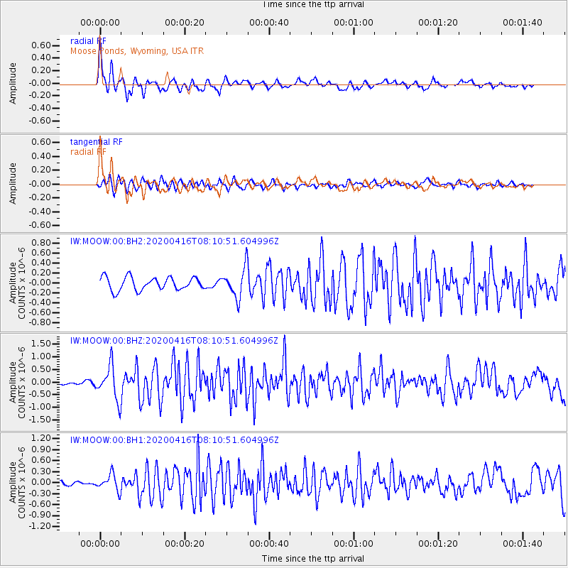
MOOW Moose Ponds, Wyoming, USA - Earthquake Result Viewer
*The percent match for this event was below the threshold and hence no stack was calculated.
| Earthquake location: |
North Of Honduras |
| Earthquake latitude/longitude: |
16.9/-85.7 |
| Earthquake time(UTC): |
2020/04/16 (107) 08:04:37 GMT |
| Earthquake Depth: |
10 km |
| Earthquake Magnitude: |
6.0 mww |
| Earthquake Catalog/Contributor: |
NEIC PDE/us |
|
| Network: |
IW Intermountain West |
| Station: |
MOOW Moose Ponds, Wyoming, USA |
| Lat/Lon: |
43.75 N/110.74 W |
| Elevation: |
2128 m |
|
| Distance: |
34.1 deg |
| Az: |
326.848 deg |
| Baz: |
133.755 deg |
| Ray Param: |
$rayparam |
*The percent match for this event was below the threshold and hence was not used in the summary stack. |
|
| Radial Match: |
77.60633 % |
| Radial Bump: |
400 |
| Transverse Match: |
72.31791 % |
| Transverse Bump: |
400 |
| SOD ConfigId: |
21166931 |
| Insert Time: |
2020-04-30 08:18:22.814 +0000 |
| GWidth: |
2.5 |
| Max Bumps: |
400 |
| Tol: |
0.001 |
|
Signal To Noise
| Channel | StoN | STA | LTA |
| IW:MOOW:00:BHZ:20200416T08:10:51.604996Z | 7.690756 | 6.858856E-7 | 8.918312E-8 |
| IW:MOOW:00:BH1:20200416T08:10:51.604996Z | 3.045389 | 2.2811197E-7 | 7.490405E-8 |
| IW:MOOW:00:BH2:20200416T08:10:51.604996Z | 2.392667 | 3.096511E-7 | 1.2941672E-7 |
| Arrivals |
| Ps | |
| PpPs | |
| PsPs/PpSs | |


