You are here: Home > Network List > US - United States National Seismic Network Stations List
> Station DGMT Dagmar, Montana, USA > Earthquake Result Viewer
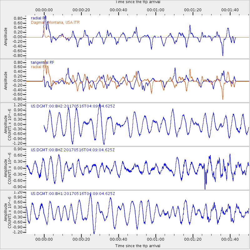
DGMT Dagmar, Montana, USA - Earthquake Result Viewer
*The percent match for this event was below the threshold and hence no stack was calculated.
| Earthquake location: |
South Of Mariana Islands |
| Earthquake latitude/longitude: |
12.4/145.1 |
| Earthquake time(UTC): |
2017/05/16 (136) 03:56:22 GMT |
| Earthquake Depth: |
40 km |
| Earthquake Magnitude: |
5.5 Mi |
| Earthquake Catalog/Contributor: |
NEIC PDE/pt |
|
| Network: |
US United States National Seismic Network |
| Station: |
DGMT Dagmar, Montana, USA |
| Lat/Lon: |
48.47 N/104.20 W |
| Elevation: |
0.0 m |
|
| Distance: |
94.0 deg |
| Az: |
38.628 deg |
| Baz: |
293.577 deg |
| Ray Param: |
$rayparam |
*The percent match for this event was below the threshold and hence was not used in the summary stack. |
|
| Radial Match: |
52.026016 % |
| Radial Bump: |
400 |
| Transverse Match: |
43.51607 % |
| Transverse Bump: |
400 |
| SOD ConfigId: |
2028011 |
| Insert Time: |
2017-05-30 04:00:42.952 +0000 |
| GWidth: |
2.5 |
| Max Bumps: |
400 |
| Tol: |
0.001 |
|
Signal To Noise
| Channel | StoN | STA | LTA |
| US:DGMT:00:BHZ:20170516T04:09:04.625Z | 3.4478679 | 3.7425352E-7 | 1.08546374E-7 |
| US:DGMT:00:BH1:20170516T04:09:04.625Z | 1.2614855 | 4.3243378E-7 | 3.4279728E-7 |
| US:DGMT:00:BH2:20170516T04:09:04.625Z | 1.4394068 | 7.9555787E-7 | 5.5269845E-7 |
| Arrivals |
| Ps | |
| PpPs | |
| PsPs/PpSs | |


