You are here: Home > Network List > US - United States National Seismic Network Stations List
> Station HAWA Hanford, Washington, USA > Earthquake Result Viewer
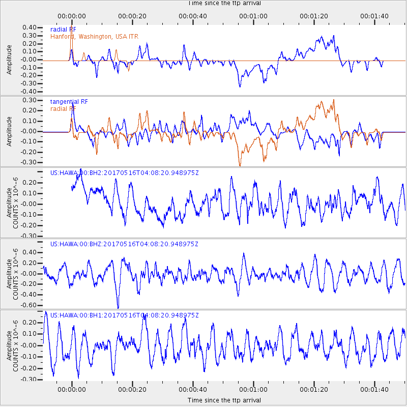
HAWA Hanford, Washington, USA - Earthquake Result Viewer
*The percent match for this event was below the threshold and hence no stack was calculated.
| Earthquake location: |
South Of Mariana Islands |
| Earthquake latitude/longitude: |
12.4/145.1 |
| Earthquake time(UTC): |
2017/05/16 (136) 03:56:22 GMT |
| Earthquake Depth: |
40 km |
| Earthquake Magnitude: |
5.5 Mi |
| Earthquake Catalog/Contributor: |
NEIC PDE/pt |
|
| Network: |
US United States National Seismic Network |
| Station: |
HAWA Hanford, Washington, USA |
| Lat/Lon: |
46.39 N/119.53 W |
| Elevation: |
364 m |
|
| Distance: |
84.8 deg |
| Az: |
43.79 deg |
| Baz: |
282.337 deg |
| Ray Param: |
$rayparam |
*The percent match for this event was below the threshold and hence was not used in the summary stack. |
|
| Radial Match: |
54.23922 % |
| Radial Bump: |
400 |
| Transverse Match: |
47.72655 % |
| Transverse Bump: |
400 |
| SOD ConfigId: |
2028011 |
| Insert Time: |
2017-05-30 04:00:52.142 +0000 |
| GWidth: |
2.5 |
| Max Bumps: |
400 |
| Tol: |
0.001 |
|
Signal To Noise
| Channel | StoN | STA | LTA |
| US:HAWA:00:BHZ:20170516T04:08:20.948975Z | 1.1693983 | 1.00283174E-7 | 8.575622E-8 |
| US:HAWA:00:BH1:20170516T04:08:20.948975Z | 1.0114954 | 1.3096924E-7 | 1.2948082E-7 |
| US:HAWA:00:BH2:20170516T04:08:20.948975Z | 1.5181375 | 1.7625244E-7 | 1.16097816E-7 |
| Arrivals |
| Ps | |
| PpPs | |
| PsPs/PpSs | |


