You are here: Home > Network List > TA - USArray Transportable Network (new EarthScope stations) Stations List
> Station D23K Nanushuk River, AK USA > Earthquake Result Viewer
D23K Nanushuk River, AK USA - Earthquake Result Viewer
*The percent match for this event was below the threshold and hence no stack was calculated.
| Earthquake location: |
North Of Honduras |
| Earthquake latitude/longitude: |
16.9/-85.7 |
| Earthquake time(UTC): |
2020/04/16 (107) 08:04:37 GMT |
| Earthquake Depth: |
10 km |
| Earthquake Magnitude: |
6.0 mww |
| Earthquake Catalog/Contributor: |
NEIC PDE/us |
|
| Network: |
TA USArray Transportable Network (new EarthScope stations) |
| Station: |
D23K Nanushuk River, AK USA |
| Lat/Lon: |
68.97 N/150.68 W |
| Elevation: |
406 m |
|
| Distance: |
65.4 deg |
| Az: |
338.914 deg |
| Baz: |
107.481 deg |
| Ray Param: |
$rayparam |
*The percent match for this event was below the threshold and hence was not used in the summary stack. |
|
| Radial Match: |
79.62474 % |
| Radial Bump: |
400 |
| Transverse Match: |
73.32367 % |
| Transverse Bump: |
400 |
| SOD ConfigId: |
21166931 |
| Insert Time: |
2020-04-30 08:22:05.546 +0000 |
| GWidth: |
2.5 |
| Max Bumps: |
400 |
| Tol: |
0.001 |
|
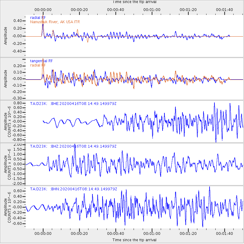
Signal To Noise
| Channel | StoN | STA | LTA |
| TA:D23K: :BHZ:20200416T08:14:49.149979Z | 3.284184 | 3.385581E-7 | 1.0308744E-7 |
| TA:D23K: :BHN:20200416T08:14:49.149979Z | 0.7814883 | 6.850403E-8 | 8.7658414E-8 |
| TA:D23K: :BHE:20200416T08:14:49.149979Z | 1.7337321 | 1.6607068E-7 | 9.578797E-8 |
| Arrivals |
| Ps | |
| PpPs | |
| PsPs/PpSs | |


