CHM KN.CHM - Earthquake Result Viewer
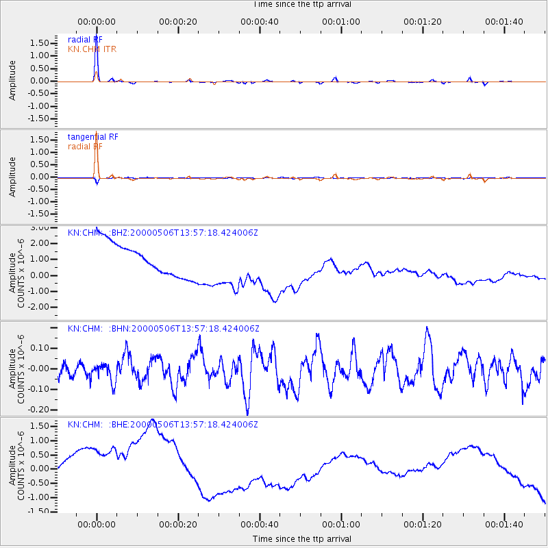
Earthquake location: Santa Cruz Islands
Earthquake latitude/longitude: -11.3/165.4
Earthquake time(UTC): 2000/05/06 (127) 13:44:13 GMT
Earthquake Depth: 12 km
Earthquake Magnitude: 6.0 MB, 6.3 MS, 6.3 MW, 5.8 ME
Earthquake Catalog/Contributor: WHDF/NEIC
Network: KN Kyrgyz Seismic Telemetry Network
Station: CHM KN.CHM
Lat/Lon: 43.00 N/74.75 E
Elevation: 655 m
Distance: 98.1 deg
Az: 312.185 deg
Baz: 97.828 deg
Ray Param: 0.04000962
Estimated Moho Depth: 35.0 km
Estimated Crust Vp/Vs: 1.67
Assumed Crust Vp: 6.306 km/s
Estimated Crust Vs: 3.776 km/s
Estimated Crust Poisson's Ratio: 0.22
Radial Match: 98.781105 %
Radial Bump: 155
Transverse Match: 92.0168 %
Transverse Bump: 384
SOD ConfigId: 3744
Insert Time: 2010-03-08 19:18:35.599 +0000
GWidth: 2.5
Max Bumps: 400
Tol: 0.001

Signal To Noise

ChannelStoNSTALTA
KN:CHM: :BHN:20000506T13:57:18.424006Z1.06681644.4439467E-84.165615E-8
KN:CHM: :BHE:20000506T13:57:18.424006Z1.44824392.1725039E-61.5000953E-6
KN:CHM: :BHZ:20000506T13:57:18.424006Z1.56891821.5976132E-61.0182896E-6
Arrivals
Ps3.8 SECOND
PpPs15 SECOND
PsPs/PpSs18 SECOND