You are here: Home > Network List > TA - USArray Transportable Network (new EarthScope stations) Stations List
> Station F26K Sheenjek River, AK, USA > Earthquake Result Viewer
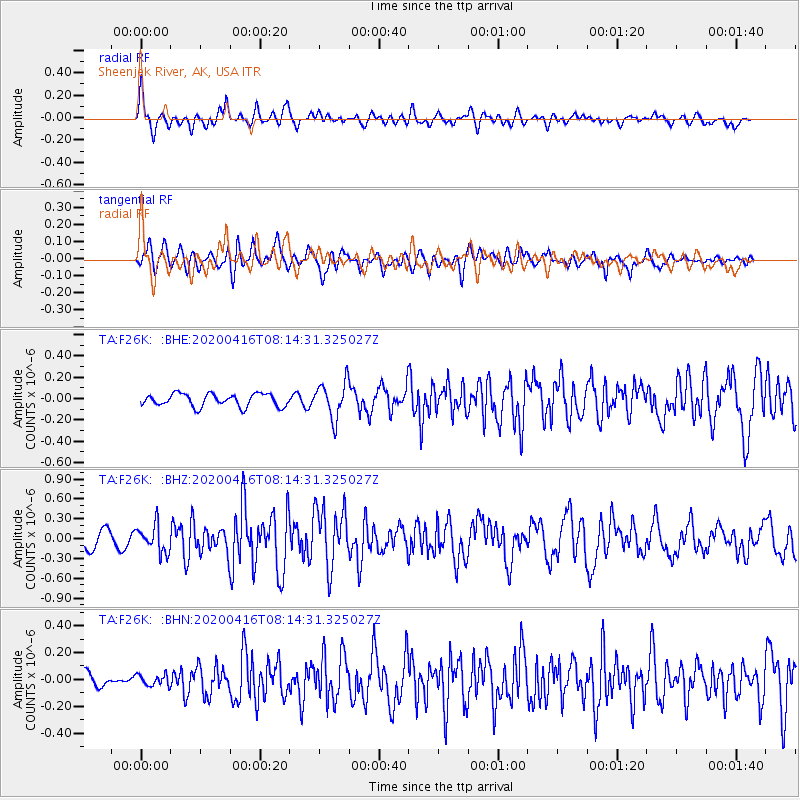
F26K Sheenjek River, AK, USA - Earthquake Result Viewer
*The percent match for this event was below the threshold and hence no stack was calculated.
| Earthquake location: |
North Of Honduras |
| Earthquake latitude/longitude: |
16.9/-85.7 |
| Earthquake time(UTC): |
2020/04/16 (107) 08:04:37 GMT |
| Earthquake Depth: |
10 km |
| Earthquake Magnitude: |
6.0 mww |
| Earthquake Catalog/Contributor: |
NEIC PDE/us |
|
| Network: |
TA USArray Transportable Network (new EarthScope stations) |
| Station: |
F26K Sheenjek River, AK, USA |
| Lat/Lon: |
67.69 N/144.15 W |
| Elevation: |
683 m |
|
| Distance: |
62.7 deg |
| Az: |
338.527 deg |
| Baz: |
113.381 deg |
| Ray Param: |
$rayparam |
*The percent match for this event was below the threshold and hence was not used in the summary stack. |
|
| Radial Match: |
77.578445 % |
| Radial Bump: |
400 |
| Transverse Match: |
67.454414 % |
| Transverse Bump: |
400 |
| SOD ConfigId: |
21166931 |
| Insert Time: |
2020-04-30 08:22:42.485 +0000 |
| GWidth: |
2.5 |
| Max Bumps: |
400 |
| Tol: |
0.001 |
|
Signal To Noise
| Channel | StoN | STA | LTA |
| TA:F26K: :BHZ:20200416T08:14:31.325027Z | 1.773347 | 2.0388147E-7 | 1.1496987E-7 |
| TA:F26K: :BHN:20200416T08:14:31.325027Z | 0.54006356 | 4.151195E-8 | 7.6864936E-8 |
| TA:F26K: :BHE:20200416T08:14:31.325027Z | 2.8609624 | 1.7059575E-7 | 5.96288E-8 |
| Arrivals |
| Ps | |
| PpPs | |
| PsPs/PpSs | |


