CHM KN.CHM - Earthquake Result Viewer
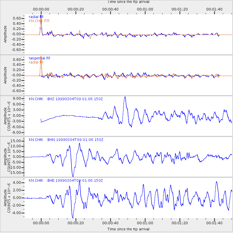
Earthquake location: Celebes Sea
Earthquake latitude/longitude: 5.4/121.9
Earthquake time(UTC): 1999/03/04 (063) 08:52:01 GMT
Earthquake Depth: 33 km
Earthquake Magnitude: 6.4 MB, 6.5 MS, 7.1 MW, 7.1 MW
Earthquake Catalog/Contributor: WHDF/NEIC
Network: KN Kyrgyz Seismic Telemetry Network
Station: CHM KN.CHM
Lat/Lon: 43.00 N/74.75 E
Elevation: 655 m
Distance: 56.0 deg
Az: 319.493 deg
Baz: 118.178 deg
Ray Param: 0.06440062
Estimated Moho Depth: 54.0 km
Estimated Crust Vp/Vs: 1.67
Assumed Crust Vp: 6.306 km/s
Estimated Crust Vs: 3.782 km/s
Estimated Crust Poisson's Ratio: 0.22
Radial Match: 95.90292 %
Radial Bump: 352
Transverse Match: 83.50057 %
Transverse Bump: 400
SOD ConfigId: 4480
Insert Time: 2010-03-08 19:18:43.824 +0000
GWidth: 2.5
Max Bumps: 400
Tol: 0.001

Signal To Noise

ChannelStoNSTALTA
KN:CHM: :BHN:19990304T09:01:06.150Z1.34714099.998173E-77.4217724E-7
KN:CHM: :BHE:19990304T09:01:06.150Z4.6413492.7275635E-75.8766613E-8
KN:CHM: :BHZ:19990304T09:01:06.150Z0.363478753.714049E-71.0218064E-6
Arrivals
Ps6.0 SECOND
PpPs22 SECOND
PsPs/PpSs28 SECOND