You are here: Home > Network List > TA - USArray Transportable Network (new EarthScope stations) Stations List
> Station I17K Unalakleet, AK, USA > Earthquake Result Viewer
I17K Unalakleet, AK, USA - Earthquake Result Viewer

| Earthquake location: |
North Of Honduras |
| Earthquake latitude/longitude: |
16.9/-85.7 |
| Earthquake time(UTC): |
2020/04/16 (107) 08:04:37 GMT |
| Earthquake Depth: |
10 km |
| Earthquake Magnitude: |
6.0 mww |
| Earthquake Catalog/Contributor: |
NEIC PDE/us |
|
| Network: |
TA USArray Transportable Network (new EarthScope stations) |
| Station: |
I17K Unalakleet, AK, USA |
| Lat/Lon: |
63.89 N/160.70 W |
| Elevation: |
105 m |
|
| Distance: |
68.3 deg |
| Az: |
332.616 deg |
| Baz: |
95.822 deg |
| Ray Param: |
0.056378428 |
| Estimated Moho Depth: |
29.5 km |
| Estimated Crust Vp/Vs: |
1.93 |
| Assumed Crust Vp: |
6.276 km/s |
| Estimated Crust Vs: |
3.248 km/s |
| Estimated Crust Poisson's Ratio: |
0.32 |
|
| Radial Match: |
91.61123 % |
| Radial Bump: |
400 |
| Transverse Match: |
77.72807 % |
| Transverse Bump: |
400 |
| SOD ConfigId: |
21166931 |
| Insert Time: |
2020-04-30 08:23:15.225 +0000 |
| GWidth: |
2.5 |
| Max Bumps: |
400 |
| Tol: |
0.001 |
|
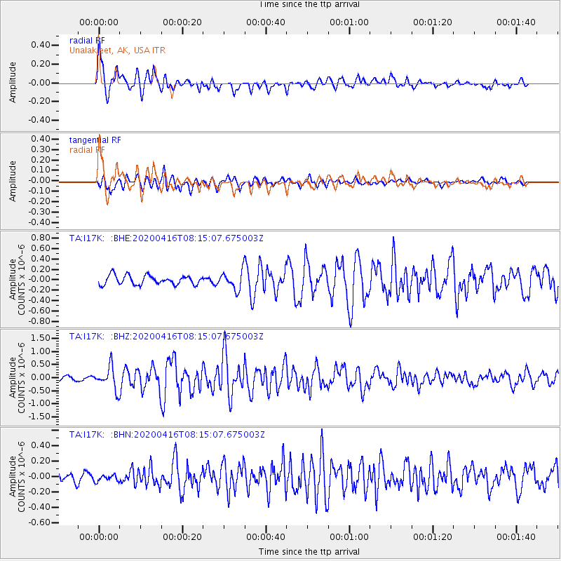
Signal To Noise
| Channel | StoN | STA | LTA |
| TA:I17K: :BHZ:20200416T08:15:07.675003Z | 6.2423143 | 4.4900872E-7 | 7.192985E-8 |
| TA:I17K: :BHN:20200416T08:15:07.675003Z | 0.5430396 | 4.3396458E-8 | 7.991398E-8 |
| TA:I17K: :BHE:20200416T08:15:07.675003Z | 2.067205 | 1.8307786E-7 | 8.856299E-8 |
| Arrivals |
| Ps | 4.5 SECOND |
| PpPs | 13 SECOND |
| PsPs/PpSs | 18 SECOND |


