You are here: Home > Network List > TA - USArray Transportable Network (new EarthScope stations) Stations List
> Station M31M Drury Creek, Yukon, CA > Earthquake Result Viewer
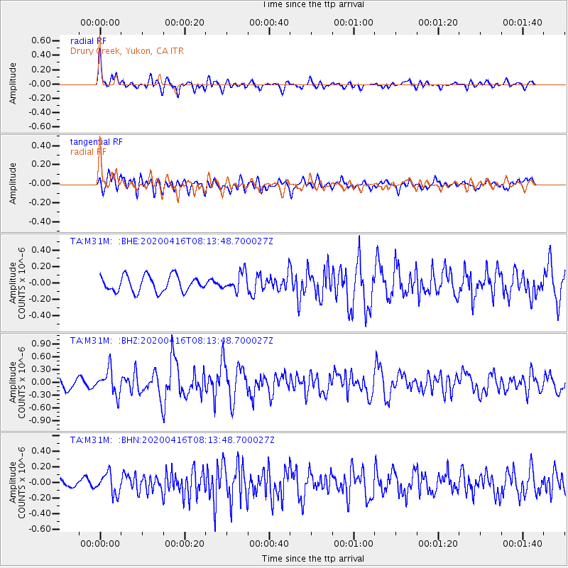
M31M Drury Creek, Yukon, CA - Earthquake Result Viewer
*The percent match for this event was below the threshold and hence no stack was calculated.
| Earthquake location: |
North Of Honduras |
| Earthquake latitude/longitude: |
16.9/-85.7 |
| Earthquake time(UTC): |
2020/04/16 (107) 08:04:37 GMT |
| Earthquake Depth: |
10 km |
| Earthquake Magnitude: |
6.0 mww |
| Earthquake Catalog/Contributor: |
NEIC PDE/us |
|
| Network: |
TA USArray Transportable Network (new EarthScope stations) |
| Station: |
M31M Drury Creek, Yukon, CA |
| Lat/Lon: |
62.20 N/134.39 W |
| Elevation: |
639 m |
|
| Distance: |
56.5 deg |
| Az: |
335.024 deg |
| Baz: |
120.445 deg |
| Ray Param: |
$rayparam |
*The percent match for this event was below the threshold and hence was not used in the summary stack. |
|
| Radial Match: |
79.46997 % |
| Radial Bump: |
400 |
| Transverse Match: |
67.06875 % |
| Transverse Bump: |
400 |
| SOD ConfigId: |
21166931 |
| Insert Time: |
2020-04-30 08:23:52.755 +0000 |
| GWidth: |
2.5 |
| Max Bumps: |
400 |
| Tol: |
0.001 |
|
Signal To Noise
| Channel | StoN | STA | LTA |
| TA:M31M: :BHZ:20200416T08:13:48.700027Z | 2.5803742 | 2.9765192E-7 | 1.1535223E-7 |
| TA:M31M: :BHN:20200416T08:13:48.700027Z | 1.7928166 | 1.3375778E-7 | 7.460762E-8 |
| TA:M31M: :BHE:20200416T08:13:48.700027Z | 1.1859859 | 1.1258642E-7 | 9.4930655E-8 |
| Arrivals |
| Ps | |
| PpPs | |
| PsPs/PpSs | |


