CHM KN.CHM - Earthquake Result Viewer
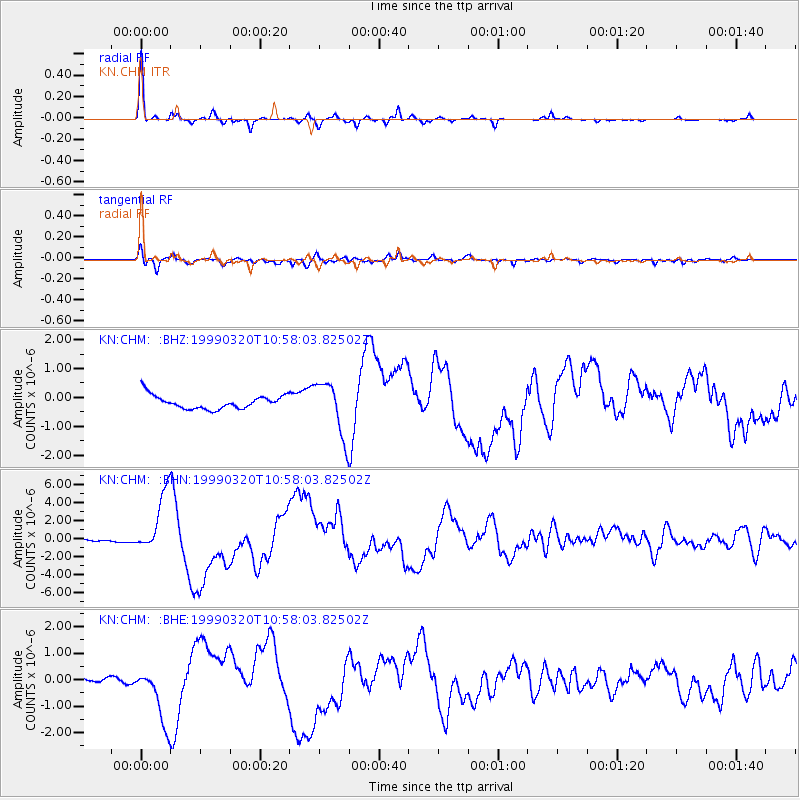
Earthquake location: Andreanof Islands, Aleutian Is.
Earthquake latitude/longitude: 51.6/-177.7
Earthquake time(UTC): 1999/03/20 (079) 10:47:45 GMT
Earthquake Depth: 33 km
Earthquake Magnitude: 6.3 MB, 6.8 MS, 6.9 MW, 6.8 ME
Earthquake Catalog/Contributor: WHDF/NEIC
Network: KN Kyrgyz Seismic Telemetry Network
Station: CHM KN.CHM
Lat/Lon: 43.00 N/74.75 E
Elevation: 655 m
Distance: 66.9 deg
Az: 310.491 deg
Baz: 40.296 deg
Ray Param: 0.057275966
Estimated Moho Depth: 60.0 km
Estimated Crust Vp/Vs: 1.62
Assumed Crust Vp: 6.306 km/s
Estimated Crust Vs: 3.899 km/s
Estimated Crust Poisson's Ratio: 0.19
Radial Match: 95.25244 %
Radial Bump: 254
Transverse Match: 79.635185 %
Transverse Bump: 400
SOD ConfigId: 4480
Insert Time: 2010-03-08 19:18:57.195 +0000
GWidth: 2.5
Max Bumps: 400
Tol: 0.001

Signal To Noise

ChannelStoNSTALTA
KN:CHM: :BHN:19990320T10:58:03.82502Z20.0299743.3579574E-61.6764662E-7
KN:CHM: :BHE:19990320T10:58:03.82502Z16.5469061.1029672E-66.6657E-8
KN:CHM: :BHZ:19990320T10:58:03.82502Z4.0721799.4412223E-72.3184694E-7
Arrivals
Ps6.1 SECOND
PpPs24 SECOND
PsPs/PpSs30 SECOND