
CHM KN.CHM - Earthquake Result Viewer
| ||||||||||||||||||
| ||||||||||||||||||
| ||||||||||||||||||
|
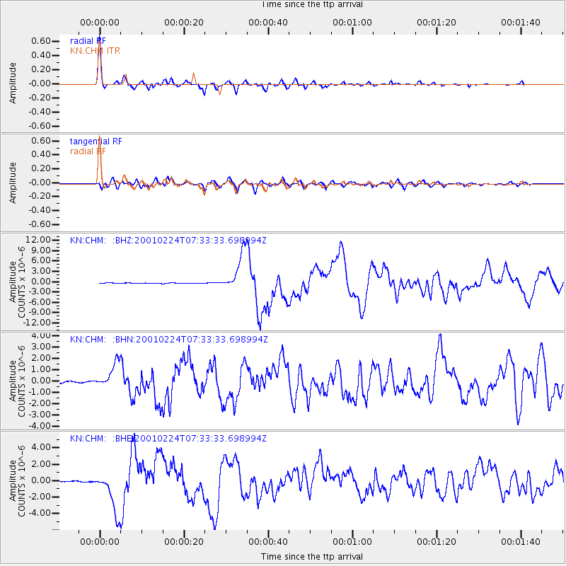
Signal To Noise
| Channel | StoN | STA | LTA |
| KN:CHM: :BHN:20010224T07:33:33.698994Z | 10.736214 | 1.2192462E-6 | 1.1356389E-7 |
| KN:CHM: :BHE:20010224T07:33:33.698994Z | 36.73702 | 2.6168564E-6 | 7.123214E-8 |
| KN:CHM: :BHZ:20010224T07:33:33.698994Z | 81.76421 | 5.907829E-6 | 7.225446E-8 |
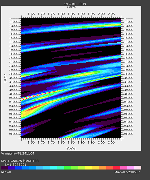
| Arrivals | |
| Ps | 5.1 SECOND |
| PpPs | 20 SECOND |
| PsPs/PpSs | 25 SECOND |

