You are here: Home > Network List > IU - Global Seismograph Network (GSN - IRIS/USGS) Stations List
> Station PMG Port Moresby, New Guinea > Earthquake Result Viewer
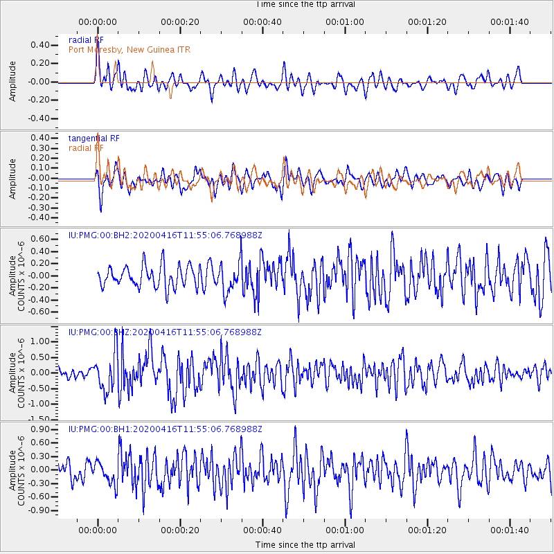
PMG Port Moresby, New Guinea - Earthquake Result Viewer
*The percent match for this event was below the threshold and hence no stack was calculated.
| Earthquake location: |
Myanmar |
| Earthquake latitude/longitude: |
22.8/94.0 |
| Earthquake time(UTC): |
2020/04/16 (107) 11:45:23 GMT |
| Earthquake Depth: |
10 km |
| Earthquake Magnitude: |
5.9 mww |
| Earthquake Catalog/Contributor: |
NEIC PDE/us |
|
| Network: |
IU Global Seismograph Network (GSN - IRIS/USGS) |
| Station: |
PMG Port Moresby, New Guinea |
| Lat/Lon: |
9.40 S/147.16 E |
| Elevation: |
90 m |
|
| Distance: |
61.1 deg |
| Az: |
115.571 deg |
| Baz: |
302.467 deg |
| Ray Param: |
$rayparam |
*The percent match for this event was below the threshold and hence was not used in the summary stack. |
|
| Radial Match: |
70.581635 % |
| Radial Bump: |
400 |
| Transverse Match: |
67.95003 % |
| Transverse Bump: |
400 |
| SOD ConfigId: |
21166931 |
| Insert Time: |
2020-04-30 11:53:16.928 +0000 |
| GWidth: |
2.5 |
| Max Bumps: |
400 |
| Tol: |
0.001 |
|
Signal To Noise
| Channel | StoN | STA | LTA |
| IU:PMG:00:BHZ:20200416T11:55:06.768988Z | 4.8511105 | 6.3753015E-7 | 1.3141943E-7 |
| IU:PMG:00:BH1:20200416T11:55:06.768988Z | 1.3204851 | 2.47938E-7 | 1.8776282E-7 |
| IU:PMG:00:BH2:20200416T11:55:06.768988Z | 1.4747756 | 2.545049E-7 | 1.7257196E-7 |
| Arrivals |
| Ps | |
| PpPs | |
| PsPs/PpSs | |


