CHM KN.CHM - Earthquake Result Viewer
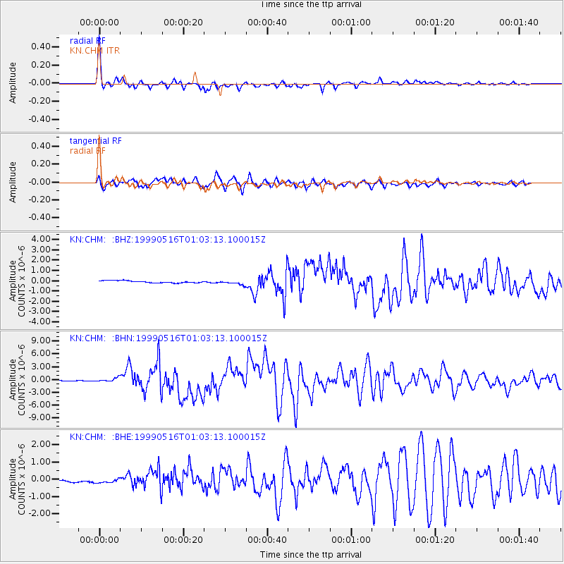
Earthquake location: New Britain Region, P.N.G.
Earthquake latitude/longitude: -4.8/152.5
Earthquake time(UTC): 1999/05/16 (136) 00:51:20 GMT
Earthquake Depth: 74 km
Earthquake Magnitude: 6.0 MB, 7.0 MS, 7.1 MW, 6.3 ME
Earthquake Catalog/Contributor: WHDF/NEIC
Network: KN Kyrgyz Seismic Telemetry Network
Station: CHM KN.CHM
Lat/Lon: 43.00 N/74.75 E
Elevation: 655 m
Distance: 84.3 deg
Az: 313.906 deg
Baz: 101.844 deg
Ray Param: 0.045438446
Estimated Moho Depth: 31.0 km
Estimated Crust Vp/Vs: 2.09
Assumed Crust Vp: 6.306 km/s
Estimated Crust Vs: 3.021 km/s
Estimated Crust Poisson's Ratio: 0.35
Radial Match: 96.74338 %
Radial Bump: 284
Transverse Match: 90.97165 %
Transverse Bump: 400
SOD ConfigId: 4480
Insert Time: 2010-03-08 19:20:44.555 +0000
GWidth: 2.5
Max Bumps: 400
Tol: 0.001

Signal To Noise

ChannelStoNSTALTA
KN:CHM: :BHN:19990516T01:03:13.100015Z5.23393444.586577E-78.763153E-8
KN:CHM: :BHE:19990516T01:03:13.100015Z1.07491621.78945E-71.6647344E-7
KN:CHM: :BHZ:19990516T01:03:13.100015Z2.13039572.1808846E-71.0236993E-7
Arrivals
Ps5.5 SECOND
PpPs15 SECOND
PsPs/PpSs20 SECOND