You are here: Home > Network List > TA - USArray Transportable Network (new EarthScope stations) Stations List
> Station D23K Nanushuk River, AK USA > Earthquake Result Viewer
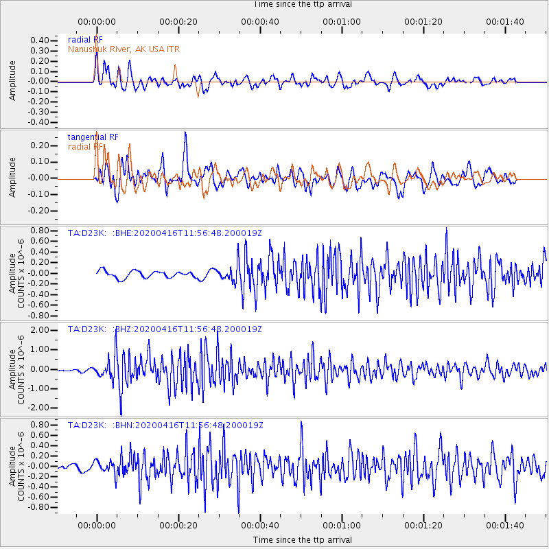
D23K Nanushuk River, AK USA - Earthquake Result Viewer
*The percent match for this event was below the threshold and hence no stack was calculated.
| Earthquake location: |
Myanmar |
| Earthquake latitude/longitude: |
22.8/94.0 |
| Earthquake time(UTC): |
2020/04/16 (107) 11:45:23 GMT |
| Earthquake Depth: |
10 km |
| Earthquake Magnitude: |
5.9 mww |
| Earthquake Catalog/Contributor: |
NEIC PDE/us |
|
| Network: |
TA USArray Transportable Network (new EarthScope stations) |
| Station: |
D23K Nanushuk River, AK USA |
| Lat/Lon: |
68.97 N/150.68 W |
| Elevation: |
406 m |
|
| Distance: |
77.5 deg |
| Az: |
19.534 deg |
| Baz: |
301.27 deg |
| Ray Param: |
$rayparam |
*The percent match for this event was below the threshold and hence was not used in the summary stack. |
|
| Radial Match: |
78.92815 % |
| Radial Bump: |
400 |
| Transverse Match: |
76.05401 % |
| Transverse Bump: |
400 |
| SOD ConfigId: |
21166931 |
| Insert Time: |
2020-04-30 11:55:39.607 +0000 |
| GWidth: |
2.5 |
| Max Bumps: |
400 |
| Tol: |
0.001 |
|
Signal To Noise
| Channel | StoN | STA | LTA |
| TA:D23K: :BHZ:20200416T11:56:48.200019Z | 9.252658 | 6.285164E-7 | 6.79282E-8 |
| TA:D23K: :BHN:20200416T11:56:48.200019Z | 1.7436726 | 1.3069483E-7 | 7.495376E-8 |
| TA:D23K: :BHE:20200416T11:56:48.200019Z | 2.6035824 | 1.6880381E-7 | 6.483521E-8 |
| Arrivals |
| Ps | |
| PpPs | |
| PsPs/PpSs | |


