You are here: Home > Network List > US - United States National Seismic Network Stations List
> Station WRAK Wrangell Island, Southeastern Alaska, Alaska, USA > Earthquake Result Viewer
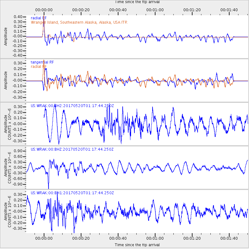
WRAK Wrangell Island, Southeastern Alaska, Alaska, USA - Earthquake Result Viewer
*The percent match for this event was below the threshold and hence no stack was calculated.
| Earthquake location: |
Negros, Philippines |
| Earthquake latitude/longitude: |
9.4/124.0 |
| Earthquake time(UTC): |
2017/05/20 (140) 01:06:13 GMT |
| Earthquake Depth: |
521 km |
| Earthquake Magnitude: |
5.9 Mww |
| Earthquake Catalog/Contributor: |
NEIC PDE/us |
|
| Network: |
US United States National Seismic Network |
| Station: |
WRAK Wrangell Island, Southeastern Alaska, Alaska, USA |
| Lat/Lon: |
56.42 N/132.35 W |
| Elevation: |
81 m |
|
| Distance: |
89.7 deg |
| Az: |
32.68 deg |
| Baz: |
286.5 deg |
| Ray Param: |
$rayparam |
*The percent match for this event was below the threshold and hence was not used in the summary stack. |
|
| Radial Match: |
63.36015 % |
| Radial Bump: |
400 |
| Transverse Match: |
56.627422 % |
| Transverse Bump: |
400 |
| SOD ConfigId: |
2028011 |
| Insert Time: |
2017-06-03 01:09:52.978 +0000 |
| GWidth: |
2.5 |
| Max Bumps: |
400 |
| Tol: |
0.001 |
|
Signal To Noise
| Channel | StoN | STA | LTA |
| US:WRAK:00:BHZ:20170520T01:17:44.250Z | 2.254231 | 3.5809444E-7 | 1.5885438E-7 |
| US:WRAK:00:BH1:20170520T01:17:44.250Z | 1.2383108 | 1.3874835E-7 | 1.1204647E-7 |
| US:WRAK:00:BH2:20170520T01:17:44.250Z | 0.8753542 | 1.4031E-7 | 1.602894E-7 |
| Arrivals |
| Ps | |
| PpPs | |
| PsPs/PpSs | |


