You are here: Home > Network List > TA - USArray Transportable Network (new EarthScope stations) Stations List
> Station I30M Mount Dempster, Yukon, CAN > Earthquake Result Viewer
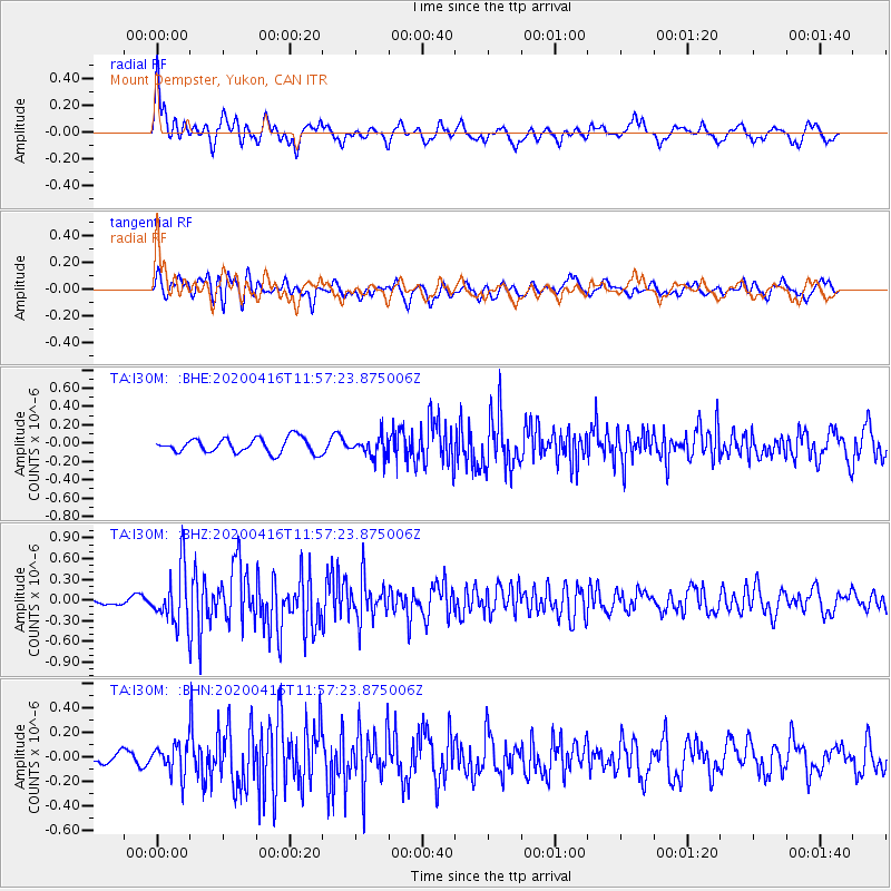
I30M Mount Dempster, Yukon, CAN - Earthquake Result Viewer
*The percent match for this event was below the threshold and hence no stack was calculated.
| Earthquake location: |
Myanmar |
| Earthquake latitude/longitude: |
22.8/94.0 |
| Earthquake time(UTC): |
2020/04/16 (107) 11:45:23 GMT |
| Earthquake Depth: |
10 km |
| Earthquake Magnitude: |
5.9 mww |
| Earthquake Catalog/Contributor: |
NEIC PDE/us |
|
| Network: |
TA USArray Transportable Network (new EarthScope stations) |
| Station: |
I30M Mount Dempster, Yukon, CAN |
| Lat/Lon: |
65.22 N/136.38 W |
| Elevation: |
1399 m |
|
| Distance: |
84.2 deg |
| Az: |
19.05 deg |
| Baz: |
314.373 deg |
| Ray Param: |
$rayparam |
*The percent match for this event was below the threshold and hence was not used in the summary stack. |
|
| Radial Match: |
59.09383 % |
| Radial Bump: |
350 |
| Transverse Match: |
62.22436 % |
| Transverse Bump: |
400 |
| SOD ConfigId: |
21166931 |
| Insert Time: |
2020-04-30 11:56:57.661 +0000 |
| GWidth: |
2.5 |
| Max Bumps: |
400 |
| Tol: |
0.001 |
|
Signal To Noise
| Channel | StoN | STA | LTA |
| TA:I30M: :BHZ:20200416T11:57:23.875006Z | 3.668392 | 3.971222E-7 | 1.08255115E-7 |
| TA:I30M: :BHN:20200416T11:57:23.875006Z | 1.5364418 | 1.2911141E-7 | 8.403274E-8 |
| TA:I30M: :BHE:20200416T11:57:23.875006Z | 1.3831837 | 1.10745546E-7 | 8.006568E-8 |
| Arrivals |
| Ps | |
| PpPs | |
| PsPs/PpSs | |


