You are here: Home > Network List > TA - USArray Transportable Network (new EarthScope stations) Stations List
> Station K13K Kusilvak Mountain, AK, USA > Earthquake Result Viewer
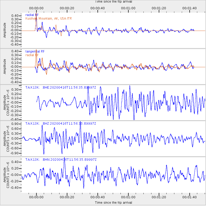
K13K Kusilvak Mountain, AK, USA - Earthquake Result Viewer
*The percent match for this event was below the threshold and hence no stack was calculated.
| Earthquake location: |
Myanmar |
| Earthquake latitude/longitude: |
22.8/94.0 |
| Earthquake time(UTC): |
2020/04/16 (107) 11:45:23 GMT |
| Earthquake Depth: |
10 km |
| Earthquake Magnitude: |
5.9 mww |
| Earthquake Catalog/Contributor: |
NEIC PDE/us |
|
| Network: |
TA USArray Transportable Network (new EarthScope stations) |
| Station: |
K13K Kusilvak Mountain, AK, USA |
| Lat/Lon: |
61.93 N/164.66 W |
| Elevation: |
204 m |
|
| Distance: |
75.3 deg |
| Az: |
28.648 deg |
| Baz: |
290.687 deg |
| Ray Param: |
$rayparam |
*The percent match for this event was below the threshold and hence was not used in the summary stack. |
|
| Radial Match: |
79.361046 % |
| Radial Bump: |
336 |
| Transverse Match: |
77.47486 % |
| Transverse Bump: |
400 |
| SOD ConfigId: |
21166931 |
| Insert Time: |
2020-04-30 11:57:03.421 +0000 |
| GWidth: |
2.5 |
| Max Bumps: |
400 |
| Tol: |
0.001 |
|
Signal To Noise
| Channel | StoN | STA | LTA |
| TA:K13K: :BHZ:20200416T11:56:35.89997Z | 3.5954187 | 3.3830284E-7 | 9.4092755E-8 |
| TA:K13K: :BHN:20200416T11:56:35.89997Z | 2.1723714 | 1.388206E-7 | 6.3902796E-8 |
| TA:K13K: :BHE:20200416T11:56:35.89997Z | 2.206354 | 1.4290728E-7 | 6.477079E-8 |
| Arrivals |
| Ps | |
| PpPs | |
| PsPs/PpSs | |


