You are here: Home > Network List > TA - USArray Transportable Network (new EarthScope stations) Stations List
> Station L15K Ungalak Mountain, AK, USA > Earthquake Result Viewer
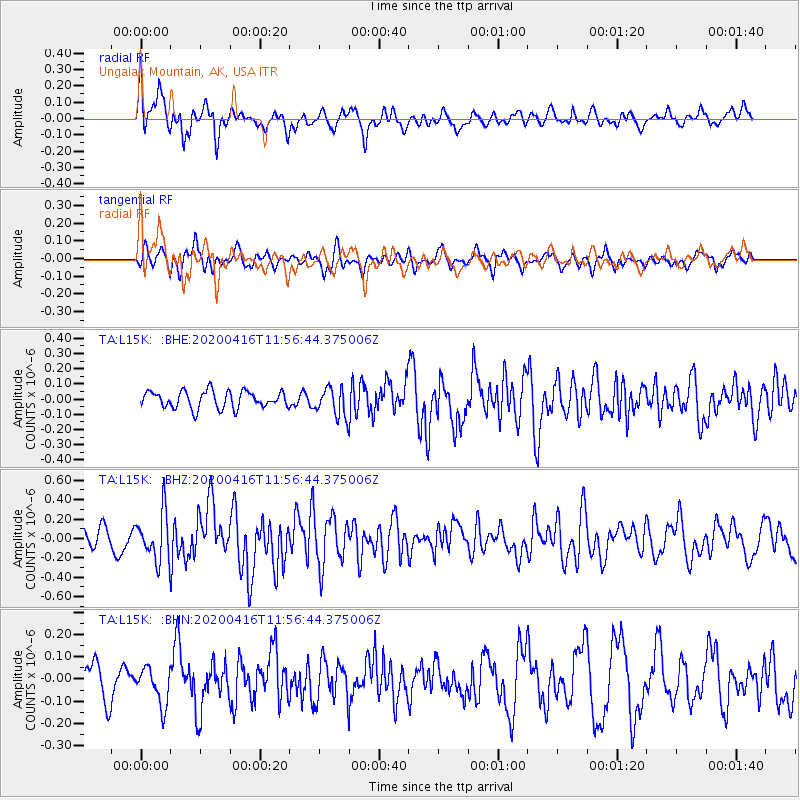
L15K Ungalak Mountain, AK, USA - Earthquake Result Viewer
*The percent match for this event was below the threshold and hence no stack was calculated.
| Earthquake location: |
Myanmar |
| Earthquake latitude/longitude: |
22.8/94.0 |
| Earthquake time(UTC): |
2020/04/16 (107) 11:45:23 GMT |
| Earthquake Depth: |
10 km |
| Earthquake Magnitude: |
5.9 mww |
| Earthquake Catalog/Contributor: |
NEIC PDE/us |
|
| Network: |
TA USArray Transportable Network (new EarthScope stations) |
| Station: |
L15K Ungalak Mountain, AK, USA |
| Lat/Lon: |
61.68 N/161.49 W |
| Elevation: |
219 m |
|
| Distance: |
76.8 deg |
| Az: |
28.311 deg |
| Baz: |
293.394 deg |
| Ray Param: |
$rayparam |
*The percent match for this event was below the threshold and hence was not used in the summary stack. |
|
| Radial Match: |
69.73212 % |
| Radial Bump: |
400 |
| Transverse Match: |
56.386208 % |
| Transverse Bump: |
400 |
| SOD ConfigId: |
21166931 |
| Insert Time: |
2020-04-30 11:57:09.006 +0000 |
| GWidth: |
2.5 |
| Max Bumps: |
400 |
| Tol: |
0.001 |
|
Signal To Noise
| Channel | StoN | STA | LTA |
| TA:L15K: :BHZ:20200416T11:56:44.375006Z | 2.1621943 | 2.447979E-7 | 1.1321734E-7 |
| TA:L15K: :BHN:20200416T11:56:44.375006Z | 1.1760839 | 8.311987E-8 | 7.067512E-8 |
| TA:L15K: :BHE:20200416T11:56:44.375006Z | 1.7010231 | 9.5212236E-8 | 5.5973512E-8 |
| Arrivals |
| Ps | |
| PpPs | |
| PsPs/PpSs | |


