CHM KN.CHM - Earthquake Result Viewer
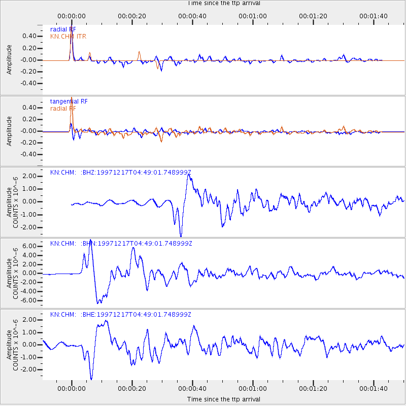
Earthquake location: Rat Islands, Aleutian Islands
Earthquake latitude/longitude: 51.2/178.9
Earthquake time(UTC): 1997/12/17 (351) 04:38:51 GMT
Earthquake Depth: 20 km
Earthquake Magnitude: 5.8 MB, 6.5 MS, 6.7 UNKNOWN, 6.1 ME
Earthquake Catalog/Contributor: WHDF/NEIC
Network: KN Kyrgyz Seismic Telemetry Network
Station: CHM KN.CHM
Lat/Lon: 43.00 N/74.75 E
Elevation: 655 m
Distance: 65.5 deg
Az: 308.539 deg
Baz: 42.142 deg
Ray Param: 0.058241133
Estimated Moho Depth: 28.0 km
Estimated Crust Vp/Vs: 1.99
Assumed Crust Vp: 6.306 km/s
Estimated Crust Vs: 3.169 km/s
Estimated Crust Poisson's Ratio: 0.33
Radial Match: 94.88999 %
Radial Bump: 324
Transverse Match: 89.71264 %
Transverse Bump: 400
SOD ConfigId: 4480
Insert Time: 2010-03-08 19:22:02.391 +0000
GWidth: 2.5
Max Bumps: 400
Tol: 0.001

Signal To Noise

ChannelStoNSTALTA
KN:CHM: :BHN:19971217T04:49:01.748999Z15.745111.5620927E-69.92113E-8
KN:CHM: :BHE:19971217T04:49:01.748999Z1.91238833.7759557E-71.9744712E-7
KN:CHM: :BHZ:19971217T04:49:01.748999Z4.976165.9242655E-71.1905294E-7
Arrivals
Ps4.6 SECOND
PpPs13 SECOND
PsPs/PpSs17 SECOND