You are here: Home > Network List > TS - TERRAscope (Southern California Seismic Network) Stations List
> Station SBC Santa Barbara, California, USA > Earthquake Result Viewer
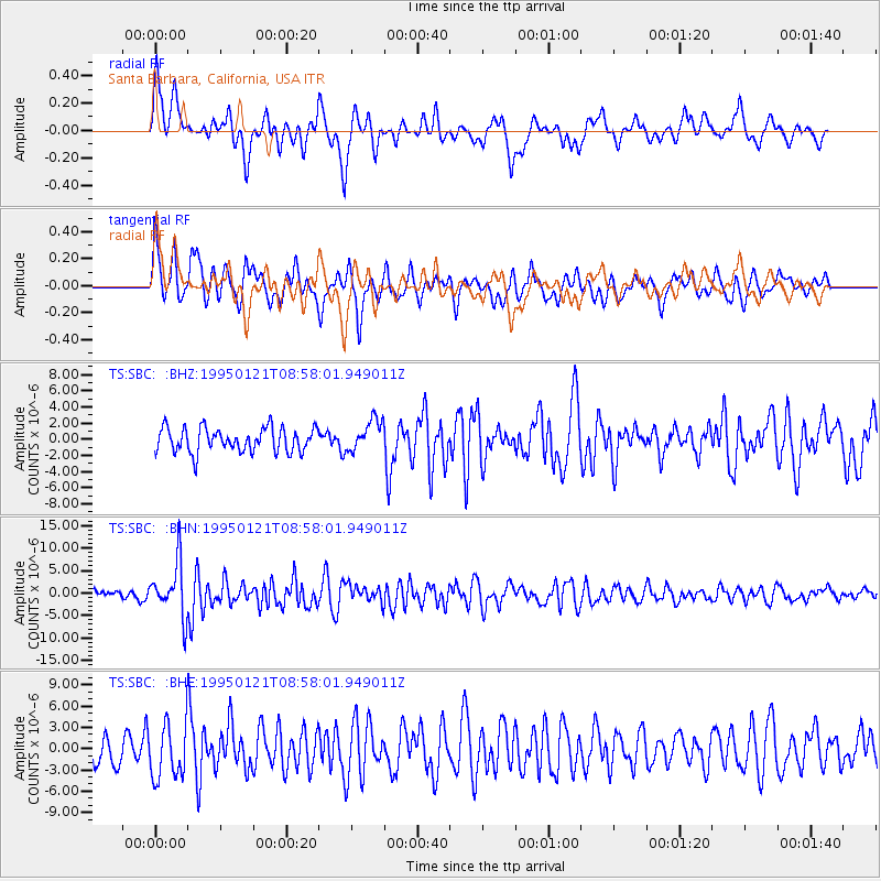
SBC Santa Barbara, California, USA - Earthquake Result Viewer
*The percent match for this event was below the threshold and hence no stack was calculated.
| Earthquake location: |
Kuril Islands |
| Earthquake latitude/longitude: |
43.3/146.7 |
| Earthquake time(UTC): |
1995/01/21 (021) 08:47:29 GMT |
| Earthquake Depth: |
63 km |
| Earthquake Magnitude: |
6.5 MB, 6.6 UNKNOWN, 6.4 MW |
| Earthquake Catalog/Contributor: |
WHDF/NEIC |
|
| Network: |
TS TERRAscope (Southern California Seismic Network) |
| Station: |
SBC Santa Barbara, California, USA |
| Lat/Lon: |
34.44 N/119.71 W |
| Elevation: |
90 m |
|
| Distance: |
69.7 deg |
| Az: |
61.602 deg |
| Baz: |
309.048 deg |
| Ray Param: |
$rayparam |
*The percent match for this event was below the threshold and hence was not used in the summary stack. |
|
| Radial Match: |
66.46509 % |
| Radial Bump: |
400 |
| Transverse Match: |
61.728203 % |
| Transverse Bump: |
400 |
| SOD ConfigId: |
4480 |
| Insert Time: |
2010-02-26 14:47:33.112 +0000 |
| GWidth: |
2.5 |
| Max Bumps: |
400 |
| Tol: |
0.001 |
|
Signal To Noise
| Channel | StoN | STA | LTA |
| TS:SBC: :BHN:19950121T08:58:01.949011Z | 5.0020037 | 6.0350753E-6 | 1.2065316E-6 |
| TS:SBC: :BHE:19950121T08:58:01.949011Z | 1.5283065 | 3.837857E-6 | 2.5111826E-6 |
| TS:SBC: :BHZ:19950121T08:58:01.949011Z | 1.2826235 | 1.9201154E-6 | 1.4970218E-6 |
| Arrivals |
| Ps | |
| PpPs | |
| PsPs/PpSs | |


