You are here: Home > Network List > TJ - Tajikistan National Seismic Network Stations List
> Station GARM Garm, Tajikistan > Earthquake Result Viewer
GARM Garm, Tajikistan - Earthquake Result Viewer
*The percent match for this event was below the threshold and hence no stack was calculated.
| Earthquake location: |
Mid-Indian Ridge |
| Earthquake latitude/longitude: |
-23.8/69.4 |
| Earthquake time(UTC): |
2020/04/17 (108) 16:30:48 GMT |
| Earthquake Depth: |
10 km |
| Earthquake Magnitude: |
5.7 mww |
| Earthquake Catalog/Contributor: |
NEIC PDE/us |
|
| Network: |
TJ Tajikistan National Seismic Network |
| Station: |
GARM Garm, Tajikistan |
| Lat/Lon: |
39.00 N/70.32 E |
| Elevation: |
1305 m |
|
| Distance: |
62.4 deg |
| Az: |
0.776 deg |
| Baz: |
180.912 deg |
| Ray Param: |
$rayparam |
*The percent match for this event was below the threshold and hence was not used in the summary stack. |
|
| Radial Match: |
38.407795 % |
| Radial Bump: |
400 |
| Transverse Match: |
50.554764 % |
| Transverse Bump: |
400 |
| SOD ConfigId: |
21166931 |
| Insert Time: |
2020-05-01 16:36:43.178 +0000 |
| GWidth: |
2.5 |
| Max Bumps: |
400 |
| Tol: |
0.001 |
|
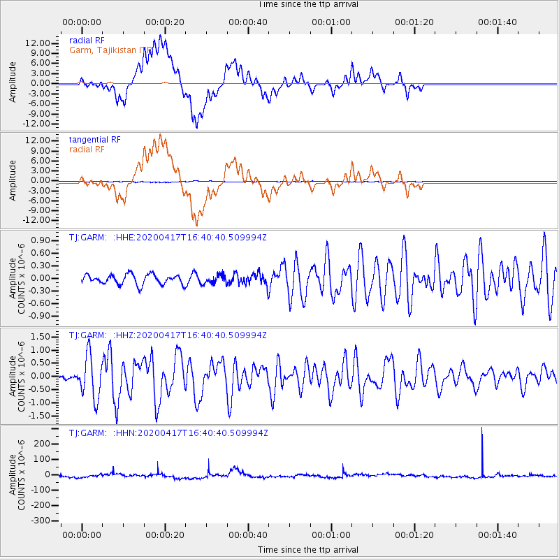
Signal To Noise
| Channel | StoN | STA | LTA |
| TJ:GARM: :HHZ:20200417T16:40:40.509994Z | 9.709736 | 8.1720844E-7 | 8.4163815E-8 |
| TJ:GARM: :HHN:20200417T16:40:40.509994Z | 0.89361095 | 8.38566E-6 | 9.384017E-6 |
| TJ:GARM: :HHE:20200417T16:40:40.509994Z | 0.89496094 | 1.0407452E-7 | 1.16289456E-7 |
| Arrivals |
| Ps | |
| PpPs | |
| PsPs/PpSs | |


