CHM KN.CHM - Earthquake Result Viewer
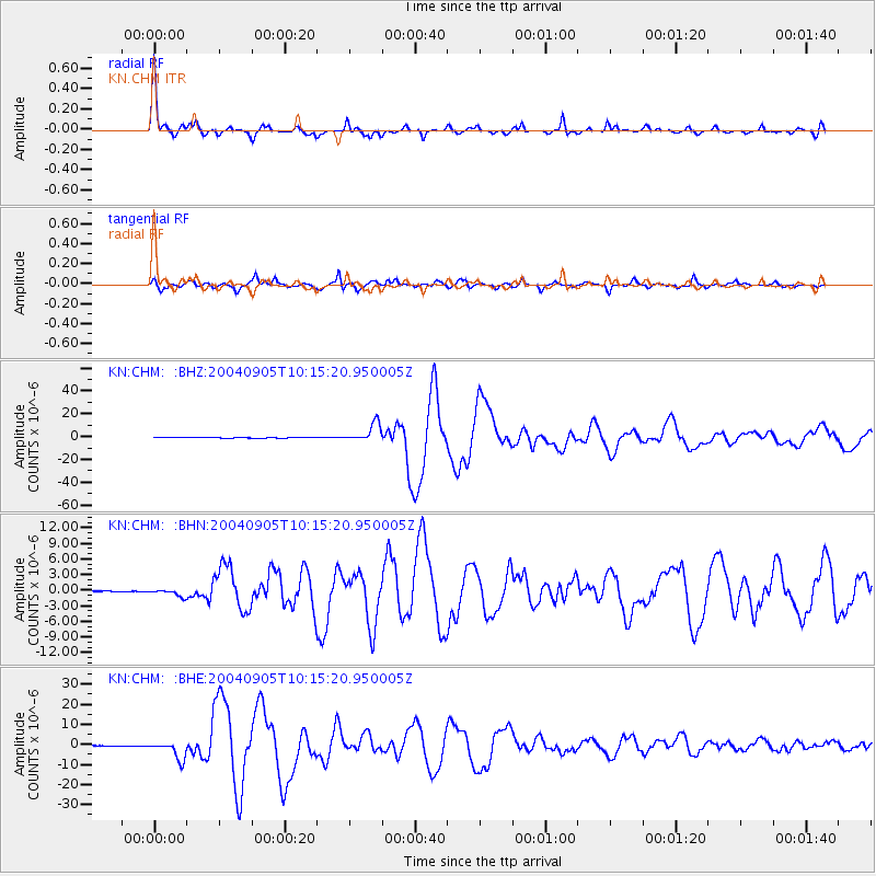
Earthquake location: Near S. Coast Of Western Honshu
Earthquake latitude/longitude: 33.1/136.6
Earthquake time(UTC): 2004/09/05 (249) 10:07:07 GMT
Earthquake Depth: 14 km
Earthquake Magnitude: 6.7 MB, 7.0 MS, 7.2 MW, 7.0 MW
Earthquake Catalog/Contributor: WHDF/NEIC
Network: KN Kyrgyz Seismic Telemetry Network
Station: CHM KN.CHM
Lat/Lon: 43.00 N/74.75 E
Elevation: 655 m
Distance: 48.7 deg
Az: 300.606 deg
Baz: 80.088 deg
Ray Param: 0.06915173
Estimated Moho Depth: 63.5 km
Estimated Crust Vp/Vs: 2.10
Assumed Crust Vp: 6.306 km/s
Estimated Crust Vs: 3.006 km/s
Estimated Crust Poisson's Ratio: 0.35
Radial Match: 95.118835 %
Radial Bump: 248
Transverse Match: 88.15633 %
Transverse Bump: 400
SOD ConfigId: 2459
Insert Time: 2010-03-08 19:22:56.090 +0000
GWidth: 2.5
Max Bumps: 400
Tol: 0.001

Signal To Noise

ChannelStoNSTALTA
KN:CHM: :BHN:20040905T10:15:20.950005Z19.689546.977113E-73.543563E-8
KN:CHM: :BHE:20040905T10:15:20.950005Z60.431144.5934576E-67.601143E-8
KN:CHM: :BHZ:20040905T10:15:20.950005Z117.9493948.026569E-66.805096E-8
Arrivals
Ps12 SECOND
PpPs30 SECOND
PsPs/PpSs41 SECOND