CHM KN.CHM - Earthquake Result Viewer
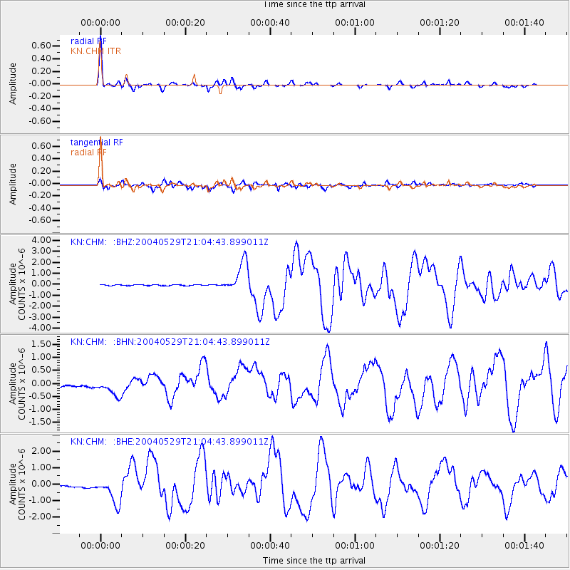
Earthquake location: Off East Coast Of Honshu, Japan
Earthquake latitude/longitude: 34.3/141.4
Earthquake time(UTC): 2004/05/29 (150) 20:56:09 GMT
Earthquake Depth: 16 km
Earthquake Magnitude: 5.6 MB, 6.6 MS, 6.5 MW, 6.3 MW
Earthquake Catalog/Contributor: WHDF/NEIC
Network: KN Kyrgyz Seismic Telemetry Network
Station: CHM KN.CHM
Lat/Lon: 43.00 N/74.75 E
Elevation: 655 m
Distance: 51.6 deg
Az: 300.703 deg
Baz: 76.117 deg
Ray Param: 0.06731134
Estimated Moho Depth: 47.25 km
Estimated Crust Vp/Vs: 1.76
Assumed Crust Vp: 6.306 km/s
Estimated Crust Vs: 3.583 km/s
Estimated Crust Poisson's Ratio: 0.26
Radial Match: 96.49656 %
Radial Bump: 218
Transverse Match: 85.7446 %
Transverse Bump: 400
SOD ConfigId: 2459
Insert Time: 2010-03-08 19:23:05.634 +0000
GWidth: 2.5
Max Bumps: 400
Tol: 0.001

Signal To Noise

ChannelStoNSTALTA
KN:CHM: :BHN:20040529T21:04:43.899011Z1.57756412.1978634E-71.3932008E-7
KN:CHM: :BHE:20040529T21:04:43.899011Z12.9406397.9033964E-76.107424E-8
KN:CHM: :BHZ:20040529T21:04:43.899011Z35.3758351.4788842E-64.1804928E-8
Arrivals
Ps6.0 SECOND
PpPs20 SECOND
PsPs/PpSs26 SECOND