
CHM KN.CHM - Earthquake Result Viewer

| ||||||||||||||||||
| ||||||||||||||||||
| ||||||||||||||||||
|
Signal To Noise
| Channel | StoN | STA | LTA |
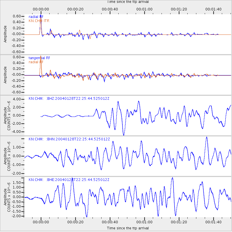
| KN:CHM: :BHN:20040128T22:25:44.525012Z | 1.5634582 | 2.2201893E-7 | 1.4200502E-7 |
| KN:CHM: :BHE:20040128T22:25:44.525012Z | 2.594931 | 3.242142E-7 | 1.2494137E-7 |
| KN:CHM: :BHZ:20040128T22:25:44.525012Z | 4.818456 | 7.696063E-7 | 1.5972051E-7 |
| Arrivals | |
| Ps | 5.6 SECOND |
| PpPs | 17 SECOND |
| PsPs/PpSs | 22 SECOND |

