You are here: Home > Network List > AV - Alaska Volcano Observatory Stations List
> Station AMKA Regional Station, Amchitka Island, Alaska > Earthquake Result Viewer
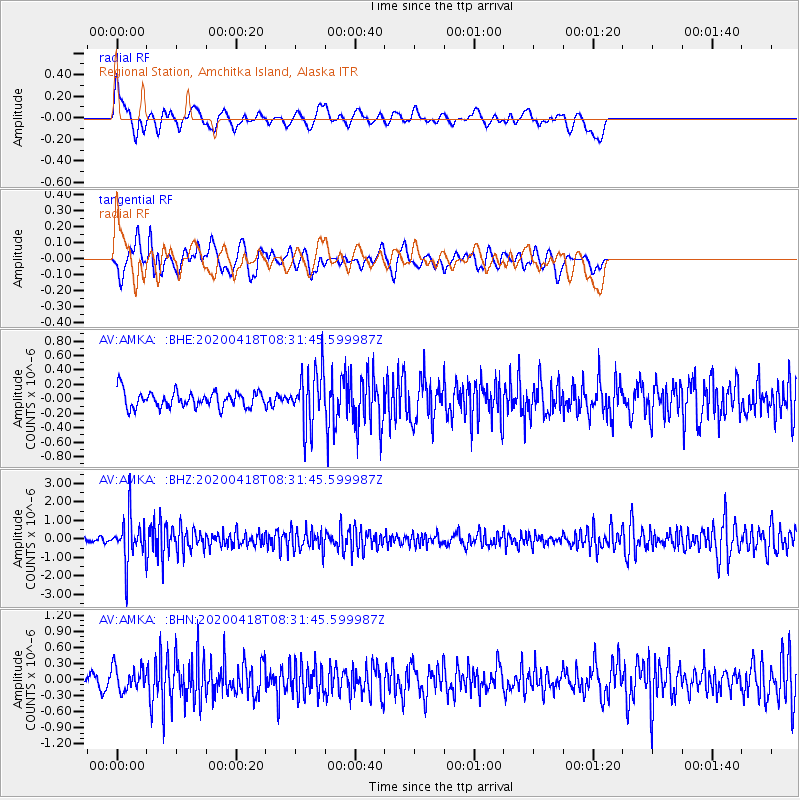
AMKA Regional Station, Amchitka Island, Alaska - Earthquake Result Viewer
*The percent match for this event was below the threshold and hence no stack was calculated.
| Earthquake location: |
Bonin Islands, Japan Region |
| Earthquake latitude/longitude: |
27.1/140.1 |
| Earthquake time(UTC): |
2020/04/18 (109) 08:25:37 GMT |
| Earthquake Depth: |
454 km |
| Earthquake Magnitude: |
6.6 Mww |
| Earthquake Catalog/Contributor: |
NEIC PDE/us |
|
| Network: |
AV Alaska Volcano Observatory |
| Station: |
AMKA Regional Station, Amchitka Island, Alaska |
| Lat/Lon: |
51.38 N/179.30 E |
| Elevation: |
116 m |
|
| Distance: |
38.1 deg |
| Az: |
39.882 deg |
| Baz: |
245.742 deg |
| Ray Param: |
$rayparam |
*The percent match for this event was below the threshold and hence was not used in the summary stack. |
|
| Radial Match: |
61.715 % |
| Radial Bump: |
400 |
| Transverse Match: |
49.13938 % |
| Transverse Bump: |
400 |
| SOD ConfigId: |
21166931 |
| Insert Time: |
2020-05-02 08:30:38.872 +0000 |
| GWidth: |
2.5 |
| Max Bumps: |
400 |
| Tol: |
0.001 |
|
Signal To Noise
| Channel | StoN | STA | LTA |
| AV:AMKA: :BHZ:20200418T08:31:45.599987Z | 9.286474 | 1.1994942E-6 | 1.2916573E-7 |
| AV:AMKA: :BHN:20200418T08:31:45.599987Z | 1.6070398 | 2.2371388E-7 | 1.3920868E-7 |
| AV:AMKA: :BHE:20200418T08:31:45.599987Z | 3.3899868 | 3.7617843E-7 | 1.1096752E-7 |
| Arrivals |
| Ps | |
| PpPs | |
| PsPs/PpSs | |


