You are here: Home > Network List > IU - Global Seismograph Network (GSN - IRIS/USGS) Stations List
> Station POHA Pohakuloa, Hawaii, USA > Earthquake Result Viewer
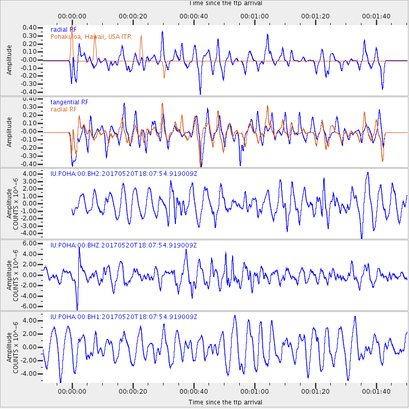
POHA Pohakuloa, Hawaii, USA - Earthquake Result Viewer
*The percent match for this event was below the threshold and hence no stack was calculated.
| Earthquake location: |
Chiapas, Mexico |
| Earthquake latitude/longitude: |
17.1/-94.0 |
| Earthquake time(UTC): |
2017/05/20 (140) 17:58:46 GMT |
| Earthquake Depth: |
144 km |
| Earthquake Magnitude: |
5.7 Mww |
| Earthquake Catalog/Contributor: |
NEIC PDE/us |
|
| Network: |
IU Global Seismograph Network (GSN - IRIS/USGS) |
| Station: |
POHA Pohakuloa, Hawaii, USA |
| Lat/Lon: |
19.76 N/155.53 W |
| Elevation: |
1990 m |
|
| Distance: |
58.2 deg |
| Az: |
282.923 deg |
| Baz: |
81.713 deg |
| Ray Param: |
$rayparam |
*The percent match for this event was below the threshold and hence was not used in the summary stack. |
|
| Radial Match: |
54.31426 % |
| Radial Bump: |
400 |
| Transverse Match: |
58.57132 % |
| Transverse Bump: |
400 |
| SOD ConfigId: |
2028011 |
| Insert Time: |
2017-06-03 18:00:46.380 +0000 |
| GWidth: |
2.5 |
| Max Bumps: |
400 |
| Tol: |
0.001 |
|
Signal To Noise
| Channel | StoN | STA | LTA |
| IU:POHA:00:BHZ:20170520T18:07:54.919009Z | 2.6205928 | 2.4498681E-6 | 9.348527E-7 |
| IU:POHA:00:BH1:20170520T18:07:54.919009Z | 1.4486818 | 2.0081802E-6 | 1.3862121E-6 |
| IU:POHA:00:BH2:20170520T18:07:54.919009Z | 1.1868526 | 1.5577282E-6 | 1.3124867E-6 |
| Arrivals |
| Ps | |
| PpPs | |
| PsPs/PpSs | |


