You are here: Home > Network List > AV - Alaska Volcano Observatory Stations List
> Station PLBL Mt. Peulik Volcano, Alaska > Earthquake Result Viewer
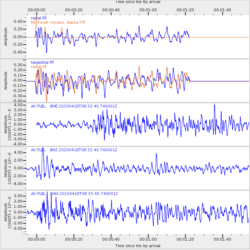
PLBL Mt. Peulik Volcano, Alaska - Earthquake Result Viewer
*The percent match for this event was below the threshold and hence no stack was calculated.
| Earthquake location: |
Bonin Islands, Japan Region |
| Earthquake latitude/longitude: |
27.1/140.1 |
| Earthquake time(UTC): |
2020/04/18 (109) 08:25:37 GMT |
| Earthquake Depth: |
454 km |
| Earthquake Magnitude: |
6.6 Mww |
| Earthquake Catalog/Contributor: |
NEIC PDE/us |
|
| Network: |
AV Alaska Volcano Observatory |
| Station: |
PLBL Mt. Peulik Volcano, Alaska |
| Lat/Lon: |
57.70 N/156.82 W |
| Elevation: |
461 m |
|
| Distance: |
53.2 deg |
| Az: |
36.734 deg |
| Baz: |
263.052 deg |
| Ray Param: |
$rayparam |
*The percent match for this event was below the threshold and hence was not used in the summary stack. |
|
| Radial Match: |
62.57524 % |
| Radial Bump: |
400 |
| Transverse Match: |
61.72527 % |
| Transverse Bump: |
400 |
| SOD ConfigId: |
21166931 |
| Insert Time: |
2020-05-02 08:31:52.806 +0000 |
| GWidth: |
2.5 |
| Max Bumps: |
400 |
| Tol: |
0.001 |
|
Signal To Noise
| Channel | StoN | STA | LTA |
| AV:PLBL: :BHZ:20200418T08:33:40.740001Z | 9.030929 | 2.1485625E-6 | 2.3791159E-7 |
| AV:PLBL: :BHN:20200418T08:33:40.740001Z | 2.6998308 | 9.292954E-7 | 3.4420506E-7 |
| AV:PLBL: :BHE:20200418T08:33:40.740001Z | 3.1972735 | 1.0142762E-6 | 3.172316E-7 |
| Arrivals |
| Ps | |
| PpPs | |
| PsPs/PpSs | |


