You are here: Home > Network List > CI - Caltech Regional Seismic Network Stations List
> Station FUR Furnace Creek, CA, USA > Earthquake Result Viewer
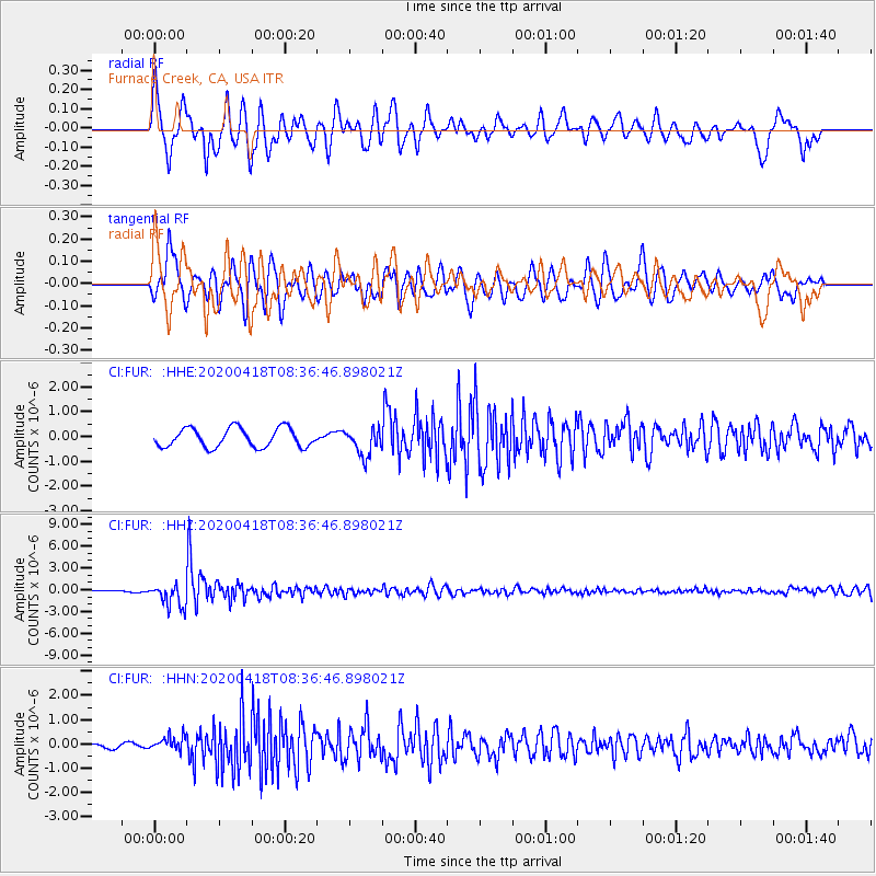
FUR Furnace Creek, CA, USA - Earthquake Result Viewer
*The percent match for this event was below the threshold and hence no stack was calculated.
| Earthquake location: |
Bonin Islands, Japan Region |
| Earthquake latitude/longitude: |
27.1/140.1 |
| Earthquake time(UTC): |
2020/04/18 (109) 08:25:37 GMT |
| Earthquake Depth: |
454 km |
| Earthquake Magnitude: |
6.6 Mww |
| Earthquake Catalog/Contributor: |
NEIC PDE/us |
|
| Network: |
CI Caltech Regional Seismic Network |
| Station: |
FUR Furnace Creek, CA, USA |
| Lat/Lon: |
36.47 N/116.86 W |
| Elevation: |
-37.0 m |
|
| Distance: |
83.9 deg |
| Az: |
52.171 deg |
| Baz: |
299.172 deg |
| Ray Param: |
$rayparam |
*The percent match for this event was below the threshold and hence was not used in the summary stack. |
|
| Radial Match: |
76.02006 % |
| Radial Bump: |
400 |
| Transverse Match: |
75.645035 % |
| Transverse Bump: |
400 |
| SOD ConfigId: |
21166931 |
| Insert Time: |
2020-05-02 08:35:07.926 +0000 |
| GWidth: |
2.5 |
| Max Bumps: |
400 |
| Tol: |
0.001 |
|
Signal To Noise
| Channel | StoN | STA | LTA |
| CI:FUR: :HHZ:20200418T08:36:46.898021Z | 14.563642 | 1.6236596E-6 | 1.114872E-7 |
| CI:FUR: :HHN:20200418T08:36:46.898021Z | 2.629054 | 2.8964345E-7 | 1.10170205E-7 |
| CI:FUR: :HHE:20200418T08:36:46.898021Z | 1.4202996 | 5.422103E-7 | 3.8175767E-7 |
| Arrivals |
| Ps | |
| PpPs | |
| PsPs/PpSs | |


