You are here: Home > Network List > CI - Caltech Regional Seismic Network Stations List
> Station SMM Simmler, CA, USA > Earthquake Result Viewer
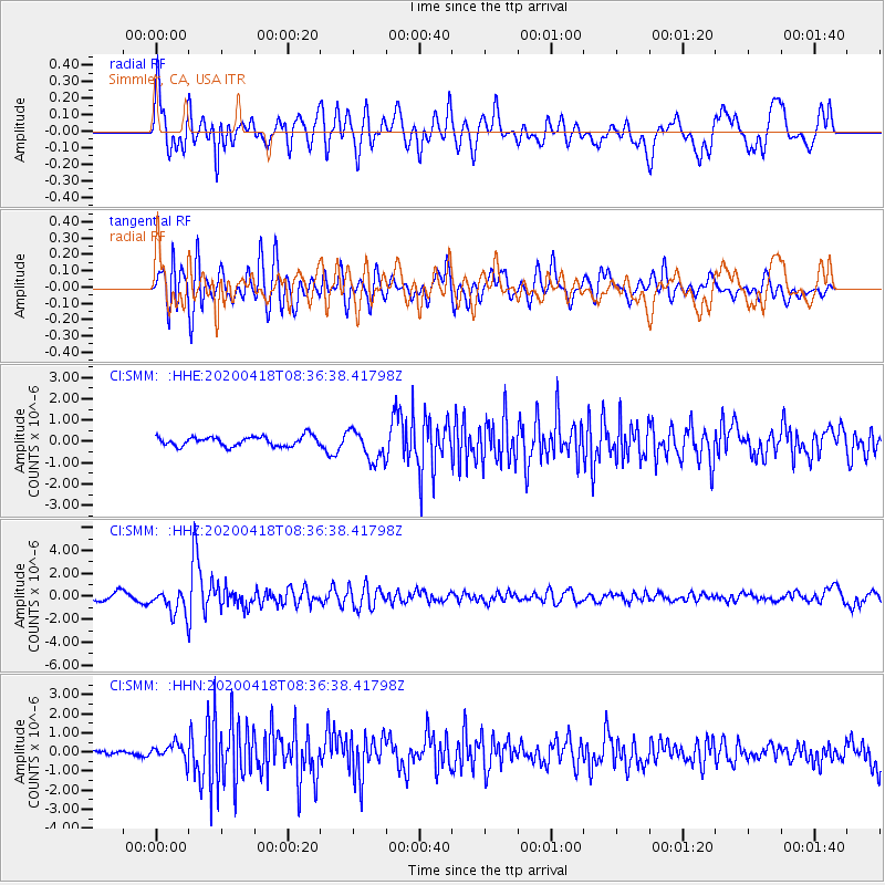
SMM Simmler, CA, USA - Earthquake Result Viewer
*The percent match for this event was below the threshold and hence no stack was calculated.
| Earthquake location: |
Bonin Islands, Japan Region |
| Earthquake latitude/longitude: |
27.1/140.1 |
| Earthquake time(UTC): |
2020/04/18 (109) 08:25:37 GMT |
| Earthquake Depth: |
454 km |
| Earthquake Magnitude: |
6.6 Mww |
| Earthquake Catalog/Contributor: |
NEIC PDE/us |
|
| Network: |
CI Caltech Regional Seismic Network |
| Station: |
SMM Simmler, CA, USA |
| Lat/Lon: |
35.31 N/120.00 W |
| Elevation: |
599 m |
|
| Distance: |
82.2 deg |
| Az: |
54.408 deg |
| Baz: |
297.615 deg |
| Ray Param: |
$rayparam |
*The percent match for this event was below the threshold and hence was not used in the summary stack. |
|
| Radial Match: |
61.889725 % |
| Radial Bump: |
400 |
| Transverse Match: |
67.284546 % |
| Transverse Bump: |
400 |
| SOD ConfigId: |
21166931 |
| Insert Time: |
2020-05-02 08:35:59.155 +0000 |
| GWidth: |
2.5 |
| Max Bumps: |
400 |
| Tol: |
0.001 |
|
Signal To Noise
| Channel | StoN | STA | LTA |
| CI:SMM: :HHZ:20200418T08:36:38.41798Z | 4.1322036 | 1.0824947E-6 | 2.6196548E-7 |
| CI:SMM: :HHN:20200418T08:36:38.41798Z | 3.0124907 | 4.4560545E-7 | 1.4791928E-7 |
| CI:SMM: :HHE:20200418T08:36:38.41798Z | 3.2676296 | 7.3494726E-7 | 2.2491757E-7 |
| Arrivals |
| Ps | |
| PpPs | |
| PsPs/PpSs | |


