You are here: Home > Network List > US - United States National Seismic Network Stations List
> Station DGMT Dagmar, Montana, USA > Earthquake Result Viewer
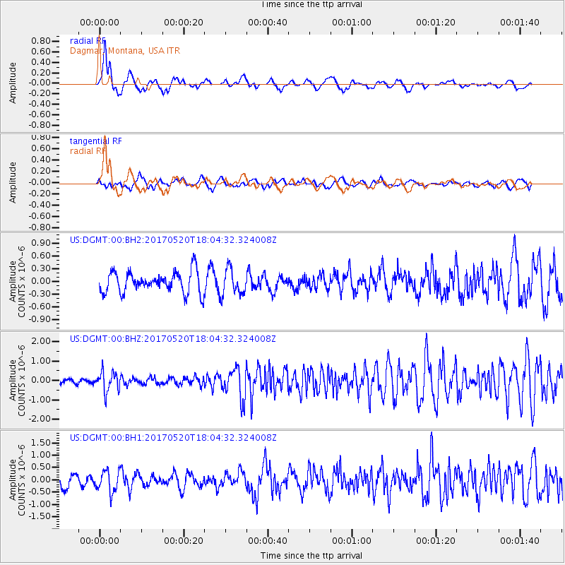
DGMT Dagmar, Montana, USA - Earthquake Result Viewer
*The percent match for this event was below the threshold and hence no stack was calculated.
| Earthquake location: |
Chiapas, Mexico |
| Earthquake latitude/longitude: |
17.1/-94.0 |
| Earthquake time(UTC): |
2017/05/20 (140) 17:58:46 GMT |
| Earthquake Depth: |
144 km |
| Earthquake Magnitude: |
5.7 Mww |
| Earthquake Catalog/Contributor: |
NEIC PDE/us |
|
| Network: |
US United States National Seismic Network |
| Station: |
DGMT Dagmar, Montana, USA |
| Lat/Lon: |
48.47 N/104.20 W |
| Elevation: |
0.0 m |
|
| Distance: |
32.4 deg |
| Az: |
347.28 deg |
| Baz: |
161.556 deg |
| Ray Param: |
$rayparam |
*The percent match for this event was below the threshold and hence was not used in the summary stack. |
|
| Radial Match: |
69.6999 % |
| Radial Bump: |
400 |
| Transverse Match: |
54.428123 % |
| Transverse Bump: |
400 |
| SOD ConfigId: |
2028011 |
| Insert Time: |
2017-06-03 18:02:58.202 +0000 |
| GWidth: |
2.5 |
| Max Bumps: |
400 |
| Tol: |
0.001 |
|
Signal To Noise
| Channel | StoN | STA | LTA |
| US:DGMT:00:BHZ:20170520T18:04:32.324008Z | 4.225576 | 5.249626E-7 | 1.2423457E-7 |
| US:DGMT:00:BH1:20170520T18:04:32.324008Z | 1.6295186 | 4.410728E-7 | 2.7067676E-7 |
| US:DGMT:00:BH2:20170520T18:04:32.324008Z | 1.2184511 | 3.034533E-7 | 2.490484E-7 |
| Arrivals |
| Ps | |
| PpPs | |
| PsPs/PpSs | |


