CHM KN.CHM - Earthquake Result Viewer
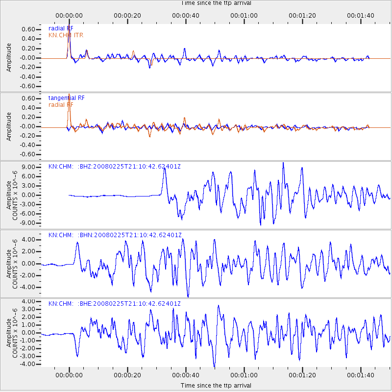
Earthquake location: Southern Sumatra, Indonesia
Earthquake latitude/longitude: -2.2/99.8
Earthquake time(UTC): 2008/02/25 (056) 21:02:18 GMT
Earthquake Depth: 25 km
Earthquake Magnitude: 6.2 MB, 6.6 MS, 6.6 MW, 6.5 MW
Earthquake Catalog/Contributor: WHDF/NEIC
Network: KN Kyrgyz Seismic Telemetry Network
Station: CHM KN.CHM
Lat/Lon: 43.00 N/74.75 E
Elevation: 655 m
Distance: 50.4 deg
Az: 336.212 deg
Baz: 146.676 deg
Ray Param: 0.06805389
Estimated Moho Depth: 55.75 km
Estimated Crust Vp/Vs: 1.63
Assumed Crust Vp: 6.306 km/s
Estimated Crust Vs: 3.869 km/s
Estimated Crust Poisson's Ratio: 0.20
Radial Match: 96.76245 %
Radial Bump: 356
Transverse Match: 89.79595 %
Transverse Bump: 400
SOD ConfigId: 2564
Insert Time: 2010-03-08 19:25:03.915 +0000
GWidth: 2.5
Max Bumps: 400
Tol: 0.001

Signal To Noise

ChannelStoNSTALTA
KN:CHM: :BHN:20080225T21:10:42.62401Z8.6696611.507751E-61.7391118E-7
KN:CHM: :BHE:20080225T21:10:42.62401Z10.7357421.1502142E-61.0713877E-7
KN:CHM: :BHZ:20080225T21:10:42.62401Z24.2934843.6747717E-61.5126574E-7
Arrivals
Ps5.9 SECOND
PpPs22 SECOND
PsPs/PpSs28 SECOND