CHM KN.CHM - Earthquake Result Viewer
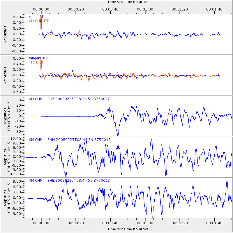
Earthquake location: Southern Sumatra, Indonesia
Earthquake latitude/longitude: -2.5/100.0
Earthquake time(UTC): 2008/02/25 (056) 08:36:33 GMT
Earthquake Depth: 25 km
Earthquake Magnitude: 6.4 MB, 7.3 MS, 7.0 MW, 6.9 MW
Earthquake Catalog/Contributor: WHDF/NEIC
Network: KN Kyrgyz Seismic Telemetry Network
Station: CHM KN.CHM
Lat/Lon: 43.00 N/74.75 E
Elevation: 655 m
Distance: 50.7 deg
Az: 336.161 deg
Baz: 146.607 deg
Ray Param: 0.06786085
Estimated Moho Depth: 57.0 km
Estimated Crust Vp/Vs: 1.60
Assumed Crust Vp: 6.306 km/s
Estimated Crust Vs: 3.941 km/s
Estimated Crust Poisson's Ratio: 0.18
Radial Match: 97.264946 %
Radial Bump: 380
Transverse Match: 92.49465 %
Transverse Bump: 400
SOD ConfigId: 2564
Insert Time: 2010-03-08 19:25:07.582 +0000
GWidth: 2.5
Max Bumps: 400
Tol: 0.001

Signal To Noise

ChannelStoNSTALTA
KN:CHM: :BHN:20080225T08:44:59.375001Z7.40924029.57706E-71.2925832E-7
KN:CHM: :BHE:20080225T08:44:59.375001Z9.4342667.882166E-78.3548265E-8
KN:CHM: :BHZ:20080225T08:44:59.375001Z21.5230052.4870826E-61.1555463E-7
Arrivals
Ps5.8 SECOND
PpPs22 SECOND
PsPs/PpSs28 SECOND