
CHM KN.CHM - Earthquake Result Viewer
| ||||||||||||||||||
| ||||||||||||||||||
| ||||||||||||||||||
|
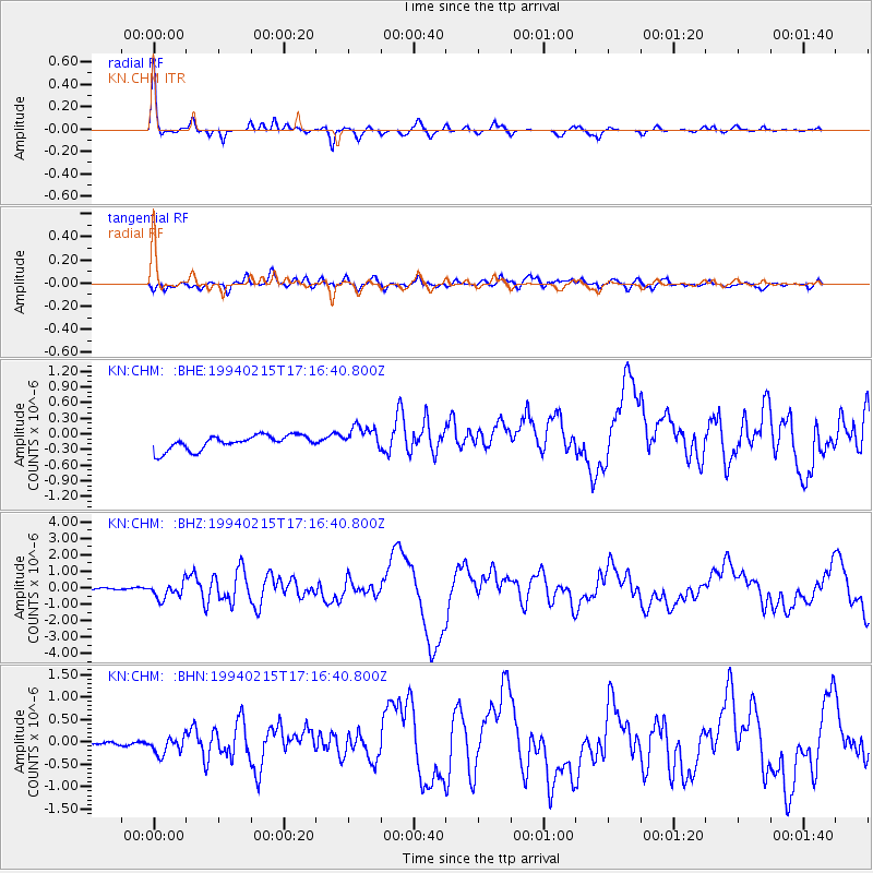
Signal To Noise
| Channel | StoN | STA | LTA |
| KN:CHM: :BHZ:19940215T17:16:40.800Z | 7.4875865 | 4.827657E-7 | 6.447547E-8 |
| KN:CHM: :BHN:19940215T17:16:40.800Z | 2.9712512 | 1.7579016E-7 | 5.9163682E-8 |
| KN:CHM: :BHE:19940215T17:16:40.800Z | 1.677559 | 2.3139026E-7 | 1.3793272E-7 |
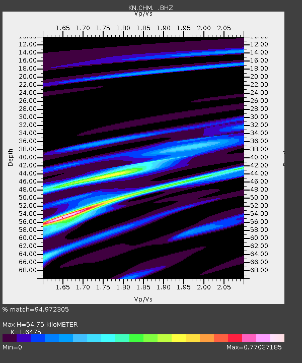
| Arrivals | |
| Ps | 5.9 SECOND |
| PpPs | 22 SECOND |
| PsPs/PpSs | 28 SECOND |

