
CHM KN.CHM - Earthquake Result Viewer
| ||||||||||||||||||
| ||||||||||||||||||
| ||||||||||||||||||
|
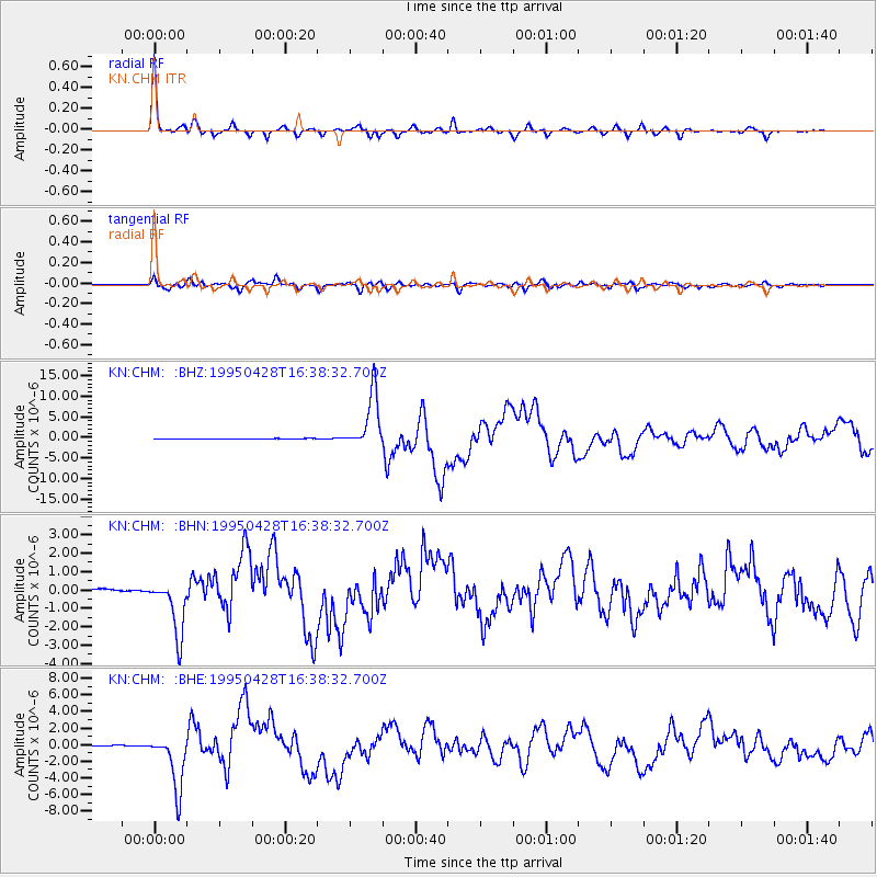
Signal To Noise
| Channel | StoN | STA | LTA |
| KN:CHM: :BHN:19950428T16:38:32.700Z | 9.421002 | 1.5196408E-6 | 1.6130352E-7 |
| KN:CHM: :BHE:19950428T16:38:32.700Z | 40.06363 | 3.3581314E-6 | 8.381995E-8 |
| KN:CHM: :BHZ:19950428T16:38:32.700Z | 98.10448 | 6.7512706E-6 | 6.881715E-8 |
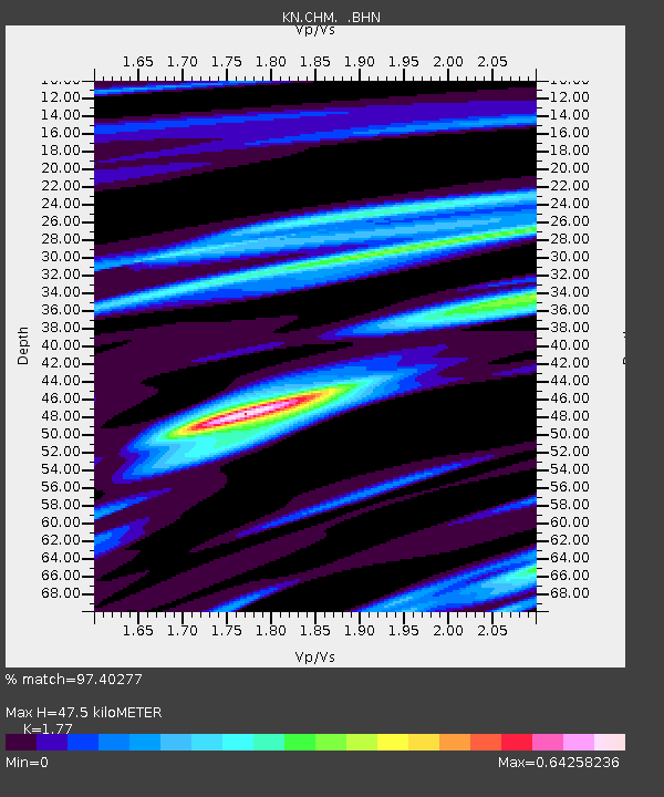
| Arrivals | |
| Ps | 6.1 SECOND |
| PpPs | 20 SECOND |
| PsPs/PpSs | 26 SECOND |

